Area Overview for Polstead
Photos of Polstead
Area Information
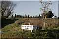
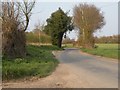
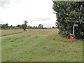
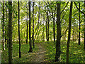
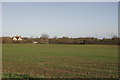
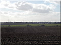
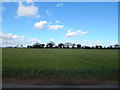
Polstead is a small civil parish located in the Babergh district of Suffolk, covering an area of 13.8 square kilometres. You will find the village situated approximately three miles northeast of Nayland and five miles southwest of Hadleigh, with Colchester lying nine miles to the south. The settlement sits on a small tributary stream of the River Stour, a geographical feature that has defined the area since its name was derived from a place by a pool. Two large ponds remain within the parish today, echoing this historical connection to water. The site of the village includes several hamlets such as Polstead Heath, Hadleigh Heath, and Bell's Corner, creating a dispersed layout rather than a single dense settlement. Living in Polstead means residing in an area with deep historical roots dating back to at least the seventh century. The community is anchored by St Mary's Church and Polstead Hall, with local amenities including a 17th-century pub called the Cock Inn and a community shop. You can enjoy annual events like the Polstice music festival held on the village playing field. The village is also notable for its association with the Red Barn Murder of 1827, a historical event commemorated by Marten's Lane and a sign near the churchyard. While the village offers peace and historical character, be aware that it contains protected woodland and falls within an Area of Outstanding Natural Beauty, which may affect future planning permissions.
- Area Type
- Parish
- Area Size
- 13.8 km²
- Population
- Not available
- Population Density
- Not available
Demographics
The community profile in Polstead shows a distinct demographic shift typical of rural parishes in the region. The median age for residents is 70 years, indicating that the population is heavily weighted towards older adults. This age distribution suggests that many people live here well past traditional retirement ages, likely drawn by the quiet lifestyle and established housing stock. Home ownership is notably high at 79%, meaning the vast majority of households in Polstead own their properties outright or have significant equity. This high ownership rate usually indicates stability and long-term residency rather than a transient rental population. The parish benefits from extremely low crime rates, with a safety score of 90 out of 100, placing it well below the national average for property crime. You can expect a neighbourhood where residents know one another and local policing resources are unlikely to be strained by antisocial behaviour. However, the very high percentage of older residents means the area may not suit young families seeking school-age entertainment or peer groups for their children. The accommodation and household composition data reflect this settled, mature nature of the community. Rather than a mix of varying family types, the data points to a homogeneous group of long-term owners, which fosters a specific type of neighbourly bond but limits the diversity often found in urban centres.
Household Size
Accommodation Type
Tenure
Ethnic Group
Religion
Household Composition
Age
Household Deprivation
NS-SEC
Explore more demographic insights in this area
Go to Demographics tabPlanning
Planning Constraints
- Flood RiskPremium
- Ramsar Wetland SitesPremium
- Area of Outstanding Natural BeautyPremium
- Protected Nature ReservePremium
- Protected WoodlandPremium