Area Overview for Pitsea North West Ward
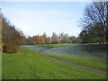
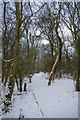
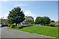
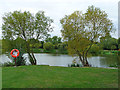
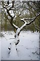
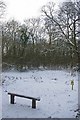
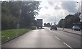
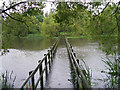
Photos of Pitsea North West Ward
Area Information
Living in Pitsea North West Ward offers a distinct experience within the broader suburban landscape of Basildon Borough in Essex. This compact district covers an area of 4.1 km² and currently houses a population of 1239 residents. You are part of a specific electoral ward that forms the north-western aspect of the town of Pitsea. The location sits at geographical coordinates within the Barstable Hundred historical district, linking back to the region's origins before its incorporation into the Basildon New Town plan in 1949. Daily life here is shaped by significant historical developments, including the relocation of the local market in 1969 and the completion of the A13 flyover in 1973. These infrastructural changes defined the modern layout of the area. You are situated in a residential zone that balances historical roots with 20th-century urban expansion. The ward provides a defined community space where local history intersects with contemporary suburban living. Your specific address places you within a planned environment that has evolved from ancient parish land to a structured part of the authority district. This context matters for anyone researching homes in this specific sector of Pitsea.
- Area Type
- District Borough Unitary Ward
- Area Size
- 4.1 km²
- Population
- 1239
- Population Density
- 301 people/km²
Demographics
The community profile of Pitsea North West Ward is characterised by an older demographic structure. The median age for residents stands at 70 years, indicating a population with a significant concentration of older individuals. This age distribution shapes the local demand for housing and the nature of day-to-day social interaction. You will find that the standard for age reporting categorises the entire population under the 'Total' age range parameter. This specific grouping reflects the current statistical snapshot of the ward's inhabitants. Home ownership represents a stable element of this community, with 51 percent of residents owning their homes outright or through a mortgage. This figure suggests a balance between owner-occupiers and other tenure types, such as private rentals or social housing. The ward accommodates a total population spread across various household compositions and accommodation types, though specific breakdowns for these categories are aggregated in the available records. The demographic data paints a picture of an established residential zone rather than a transient student or young professional hub. Understanding that the median age is 70 helps contextualise the local schools and leisure facilities available to you as a new resident.
Household Size
Accommodation Type
Tenure
Ethnic Group
Religion
Household Composition
Age
Household Deprivation
NS-SEC
Explore more demographic insights in this area
Go to Demographics tabPlanning
Planning Constraints
- Flood RiskPremium
- Ramsar Wetland SitesPremium
- Area of Outstanding Natural BeautyPremium
- Protected Nature ReservePremium
- Protected WoodlandPremium
- Crime RiskPremium