Area Overview for Pilgrims Hatch Ward
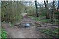
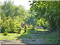
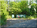
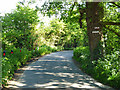
Photos of Pilgrims Hatch Ward
Area Information
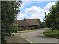
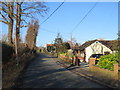
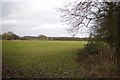
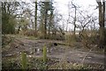
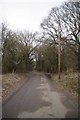
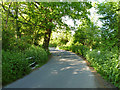
Pilgrims Hatch Ward is a residential suburb of Brentwood in Essex, covering an area of 4.7 km². This district ward includes the Bishops Hall and Flower estates situated north of the A12, alongside a small rural section stretching to Ashwells Road and Days Lane. The name originates from 12th-century pilgrimages to Canterbury, historically referred to as Pilgrims Hatch Common on maps from 1777. While development was limited initially, substantial growth occurred after the Second World War. Formerly home to a Cable & Wireless telegraph station established in 1921, the area now functions as a quiet residential zone with links to the ancient Pilgrims Way. Residents here live in a setting defined by its estate structures and proximity to significant historical sites such as Pilgrims Hall. This Regency house sits within 19 acres of gardens adjacent to the route to Canterbury, featuring records dating back to 1795 and historical extensions known as Waterloo Bows. The neighbourhood balances suburban convenience with a touch of rural character due to its geographical spread. Living in Pilgrims Hatch Ward offers access to local estates while remaining close to Brentwood's broader infrastructure. The mix of post-war housing and historical landmarks creates a distinct environment for those seeking a Brentwood suburb with depth and history. Homes in this ward benefit from established community layouts that have evolved over nearly a century of gradual development.
- Area Type
- District Borough Unitary Ward
- Area Size
- 4.7 km²
- Population
- 1491
- Population Density
- 315 people/km²
Demographics
The community in Pilgrims Hatch Ward presents a distinctly older age profile compared to the national average. The median age here is 70, with the most common demographic group formed by people in their more mature years. This indicates a neighbourhood where life often slows down, appealing to retirees or families with older parents. More than seven in ten residents, specifically 71 per cent, own their homes outright or with a mortgage, suggesting strong local stability and long-term settlement. This high home ownership rate typically correlates with lower turnover and a community invested in the area's future. Accommodation types in Pilgrims Hatch Ward reflect this established nature, with a mix of homes designed for different generations. The ward has recorded a population of 1,491 people across 4.7 square kilometres, resulting in a population density of 315 people per km². This density places the area at a moderate level for a suburban ward, neither overly crowded nor completely isolated. For those living in Pilgrims Hatch Ward, daily life revolves around established neighbourhoods rather than rapid urban expansion. The demographic makeup ensures a quiet atmosphere, though specific data on household composition limits a deeper analysis of family sizes. Ultimately, the area attracts those who prioritise stability and ownership over dense urban living. Schools near Pilgrims Hatch Ward cater to any remaining younger families seeking quality education within this demographic framework.
Household Size
Accommodation Type
Tenure
Ethnic Group
Religion
Household Composition
Age
Household Deprivation
NS-SEC
Explore more demographic insights in this area
Go to Demographics tabPlanning
Planning Constraints
- Flood RiskPremium
- Ramsar Wetland SitesPremium
- Area of Outstanding Natural BeautyPremium
- Protected Nature ReservePremium
- Protected WoodlandPremium
- Crime RiskPremium