Area Overview for Pettaugh
Photos of Pettaugh
Area Information
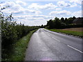
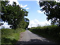
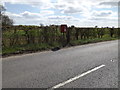
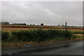
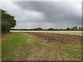
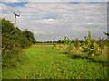
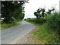
Living in Pettaugh means settling into a quiet civil parish that spans just 3.3 km² in England. This compact area defines a distinct lifestyle where residents enjoy close proximity to one another without the density of larger towns. The parish itself forms a self-contained community, offering a definitive sense of locality for those who value a contained environment. You will find yourself in a setting that prioritises peace and local knowledge over urban excitement. The geography is straightforward, limiting the space to a single small footprint where every lane and field is recognised by neighbours. This simplicity creates a predictable daily rhythm for anyone considering homes in Pettaugh. The physical scale ensures that the distance between your front door and local amenities remains short, fostering a neighbourhood where everyone knows everyone. There is no ambiguity about the location; it is a clearly defined parish with recognised boundaries. Your days here will largely unfold within these limits, offering a stable backdrop rather than the constant flux of a growing city. This clarity benefits those seeking a straightforward living situation where the rules of the road and the layout of the streets are easy to navigate.
- Area Type
- Parish
- Area Size
- 3.3 km²
- Population
- Not available
- Population Density
- Not available
Demographics
The community in Pettaugh reflects a population with a pronounced focus on retirement living. The median age stands at 70, confirming that the most common demographic is elderly residents. This age profile shapes the local culture and the types of social activities available within the parish. With 76% of households reporting home ownership, the area serves as a long-term residence rather than a temporary stop. This high ownership rate indicates that families have settled here to stay, building roots over many years. You will encounter a settled population that has accumulated wealth and tends to value stability. The data confirms that the vast majority of accommodation is occupied by owners who have chosen this specific parish. There is no indication of a transient rental market dominating the landscape. Instead, the demographic stability suggests a quiet, established neighbourhood where long-serving residents form the social core. This makes Pettaugh an ideal choice for those who prefer a predictable community with consistent neighbours rather than frequent turnover of tenants or new incomers. The statistics paint a clear picture of a place where people grow old with their homes.
Household Size
Accommodation Type
Tenure
Ethnic Group
Religion
Household Composition
Age
Household Deprivation
NS-SEC
Explore more demographic insights in this area
Go to Demographics tabPlanning
Planning Constraints
- Flood RiskPremium
- Ramsar Wetland SitesPremium
- Area of Outstanding Natural BeautyPremium
- Protected Nature ReservePremium
- Protected WoodlandPremium
- Crime RiskPremium