Area Overview for Pertenhall
Photos of Pertenhall
Area Information
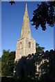
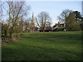
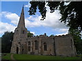
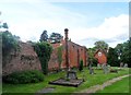
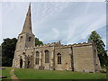
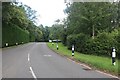
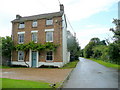
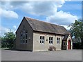
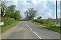
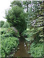
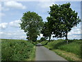
Living in Pertenhall means residing in an ancient civil parish in Bedfordshire, situated approximately 11 miles north of Bedford and close to the Huntingdonshire border. This rural community spans an area of 6.5 square kilometres and was formerly known as Peter's-Hall. The parish belongs to the Stodden Hundred of Bedfordshire and shares a parish council with Swineshead, though it maintains its own ecclesiastical identity. You will find hamlets nestled within the parish, specifically Chadwell End, Wood End, and Elvedon. Historical records show that in the 1870s, the area comprised 1,805 acres with a population of 404 housed in 95 dwellings, giving a strong sense of its humble origins. The village contains significant historical features, including a preceptory of the Knights Templars where only the site surrounded by a moat remains today. Nearby Kimbolton lies just 2 miles to the north-west. Residents here enjoy proximity to Sharnbrook railway station, which is approximately 7½ miles away. The parish church of St. Peter and St. Paul originates from the Norman period, with incumbents recorded from 1154. You can visit monuments dedicated to the Martyns family or a tablet honouring a niece of Oliver Cromwell within the church grounds. A chalybeate spring called Chadwell is also located inside the parish boundaries. This location offers a quiet rural life while remaining accessible to larger towns and historical sites.
- Area Type
- Parish
- Area Size
- 6.5 km²
- Population
- Not available
- Population Density
- Not available
Demographics
The community in Pertenhall is characterised by a mature population with a median age of 70 years. The most common age range represents the total population, indicating a settled, older demographic structure. Despite this age profile, the area maintains high levels of stability. A remarkable 83% of households are owner-occupied, suggesting deep-rooted local connections and minimal tenant turnover. This high home ownership rate reflects a traditional community where families, often retirees, have invested in their homes for the long term. You will find that the accommodation type composition is dominated by owner-occupied properties rather than rentals. While specific data on ethnic diversity is not detailed in available records, the area's long history suggests a established, perhaps predominantly white British population, typical of many Bedfordshire parishes. Religion statistics are similarly not broken down in the current data. However, the presence of the parish church and a Moravian chapel indicates a history of religious observance and community gathering. The low median age combined with high ownership points to an area where people downsize or move for retirement rather than young professionals seeking entry-level housing. This demographic reality shapes the local services and social atmosphere, focusing on leisure, healthcare, and community engagement rather than vibrant nightlife or student accommodation.
Household Size
Accommodation Type
Tenure
Ethnic Group
Religion
Household Composition
Age
Household Deprivation
NS-SEC
Explore more demographic insights in this area
Go to Demographics tabPlanning
Planning Constraints
- Flood RiskPremium
- Ramsar Wetland SitesPremium
- Area of Outstanding Natural BeautyPremium
- Protected Nature ReservePremium
- Protected WoodlandPremium