Area Overview for Penn & Mill End Ward
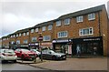
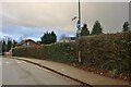
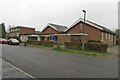
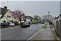
Photos of Penn & Mill End Ward
Area Information
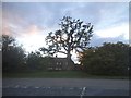
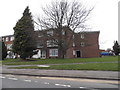
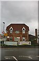
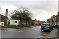
Penn & Mill End Ward sits within Buckinghamshire, forming part of the East of England region with a landmass of just 2.0 km². As an electoral ward, this compact district has grown from a population of 7,241 in 2011 to 7,200 according to the 2021 census. This slight demographic shift reflects a stable community size within its clearly defined administrative boundaries. Residents navigate a specific neighbourhood shaped by specific planning constraints and safety assessments that define daily life. The ward operates as a self-contained unit where the density of population balances with the fixed geographical size. You find yourself in an area where boundaries are precise and local governance is specific to the ward structure. Official council maps from Buckinghamshire delineate the exact limits of your surroundings. The area maintains its identity through clear electoral divisions and recognised local references. Daily living here involves engaging with a community of around seven thousand individuals within a relatively small footprint. The ward's character is established by its official designation and its position relative to broader regional structures in Buckinghamshire. Understanding this layout helps you grasp the scale of neighbourhood management and local services available to you.
- Area Type
- District Borough Unitary Ward
- Area Size
- 2.0 km²
- Population
- Not available
- Population Density
- Not available
Demographics
The community in Penn & Mill End Ward shows a demographic profile where the median age reaches 70 years. This figure indicates a population skewed significantly towards older residents compared to the national average. The most common age range recorded in the data is listed as Age: Total, reflecting the way census data aggregates specific cohorts for this ward. Home ownership stands at a high 62%, suggesting that the majority of households possess their own properties. This level of ownership points to an area where residents have long-term roots in the ward rather than viewing homes as temporary rentals. Household composition and accommodation type data exist in the records, confirming the structural nature of the households living here. The ward does not designate a single predominant ethnic group or a specific religion in the provided statistics, indicating a neutral or mixed demographic breakdown in those specific categories. You are looking at a settlement where stability and senior residency are the defining social characteristics. This age profile influences local spending habits and community engagement patterns directly. A high percentage of owner-occupiers often correlates with slower population turnover rates within the ward. The social fabric is built around a significant number of older residents maintaining their independent homes.
Household Size
Accommodation Type
Tenure
Ethnic Group
Religion
Household Composition
Age
Household Deprivation
NS-SEC
Explore more demographic insights in this area
Go to Demographics tabPlanning
Planning Constraints
- Flood RiskPremium
- Ramsar Wetland SitesPremium
- Area of Outstanding Natural BeautyPremium
- Protected Nature ReservePremium
- Protected WoodlandPremium
- Crime RiskPremium