Area Overview for PE6 7QS
Photos of PE6 7QS
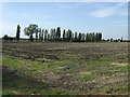
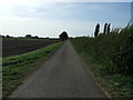
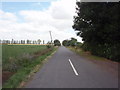
7 photos from this area
Area Information
Key information about the PE6 7QS including its size, population, and administrative classification.
- Area Type
- Postcode
- Area Size
- 8.2 hectares
- Population
- 1467
- Population Density
- 1671 people/km²
House Prices in PE6 7QS
21
Properties
£167,938
Average Sold Price
£54,500
Lowest Price
£330,000
Highest Price
Showing 21 properties
| Address | Type | Beds | Baths | Last Sale Price | Last Sale Date | |
|---|---|---|---|---|---|---|
| 22 Reedmace Close, Newborough, PE6 7QS | Chalet | 3 | 1 | £270,000 | Aug 2024 | |
| 1 Reedmace Close, Newborough, PE6 7QS | Bungalow | 3 | - | £330,000 | Feb 2023 | |
| 3 Reedmace Close, Newborough, PE6 7QS | Bungalow | 2 | 1 | £315,000 | Sep 2022 | |
| 8 Reedmace Close, Newborough, PE6 7QS | Bungalow | 2 | 1 | £232,000 | Jan 2019 | |
| 26 Reedmace Close, Newborough, PE6 7QS | house | - | - | £215,000 | Mar 2017 | |
| 14 Reedmace Close, Newborough, PE6 7QS | Bungalow | - | - | £229,000 | Jul 2010 | |
| 5 Reedmace Close, Newborough, PE6 7QS | Detached | - | - | £165,000 | May 2008 | |
| 11 Reedmace Close, Newborough, PE6 7QS | Detached | - | - | £207,500 | Sep 2007 | |
| 20 Reedmace Close, Newborough, PE6 7QS | Detached | - | - | £165,000 | Jul 2005 | |
| 12 Reedmace Close, Newborough, PE6 7QS | Detached | - | - | £142,000 | Sep 2002 |
Page 1 of 3
Energy Efficiency in PE6 7QS
Amenities
Schools
| Rank | School | Type | Entry gender | Ages |
|---|
Explore more schools in this area
Go to Schools tabDemographics
Household Size
Two person
most common
Accommodation Type
Houses
most common
Tenure
87
majority
Ethnic Group
White
most common
Religion
N/A
most common
Household Composition
N/A
most common
Age
47
median
Adults (30-64 years)
most common
Household Deprivation
N/A
with no deprivation
NS-SEC
34
in Lower managerial occupations
Explore more demographic insights in this area
Go to Demographics tabPlanning
Planning Constraints
- Flood RiskPremium
- Ramsar Wetland SitesPremium
- Area of Outstanding Natural BeautyPremium
- Protected Nature ReservePremium
- Protected WoodlandPremium