Area Overview for PE6 7DU
Photos of PE6 7DU
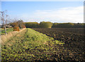
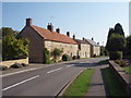
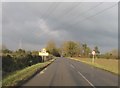
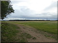
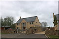
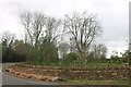
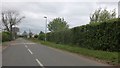
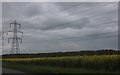
28 photos from this area
Area Information
Key information about the PE6 7DU including its size, population, and administrative classification.
- Area Type
- Postcode
- Area Size
- 77.1 hectares
- Population
- 1999
- Population Density
- 74 people/km²
House Prices in PE6 7DU
48
Properties
£373,625
Average Sold Price
£137,500
Lowest Price
£895,000
Highest Price
Showing 48 properties
| Address | Type | Beds | Baths | Last Sale Price | Last Sale Date | |
|---|---|---|---|---|---|---|
| 5A West Street, Helpston, PE6 7DU | Semi-detached | 3 | 1 | £335,000 | Jul 2025 | |
| 23 West Street, Helpston, PE6 7DU | Semi-detached | 4 | 3 | £675,000 | Oct 2024 | |
| 137 West Street, Helpston, PE6 7DU | Detached | 4 | 2 | £560,000 | Aug 2024 | |
| 35 West Street, Helpston, PE6 7DU | house | 2 | 2 | £350,000 | Oct 2023 | |
| 5B West Street, Helpston, PE6 7DU | house | - | - | £895,000 | May 2023 | |
| 31A West Street, Helpston, PE6 7DU | house | - | - | £294,000 | Mar 2020 | |
| 33 West Street, Helpston, PE6 7DU | Detached | 4 | 1 | £390,000 | Jan 2019 | |
| The Feathers, 7A West Street, Helpston, PE6 7DU | house | 4 | 1 | £700,000 | May 2018 | |
| 19 West Street, Helpston, PE6 7DU | house | 3 | 1 | £210,000 | Apr 2018 | |
| 79 West Street, Helpston, PE6 7DU | Detached | 4 | - | £385,000 | Mar 2018 |
Page 1 of 5
Energy Efficiency in PE6 7DU
Amenities
Schools
| Rank | School | Type | Entry gender | Ages |
|---|
Explore more schools in this area
Go to Schools tabDemographics
Household Size
Family (3-5 people)
most common
Accommodation Type
Houses
most common
Tenure
84
majority
Ethnic Group
White
most common
Religion
N/A
most common
Household Composition
N/A
most common
Age
47
median
Adults (30-64 years)
most common
Household Deprivation
N/A
with no deprivation
NS-SEC
48
in Lower managerial occupations
Explore more demographic insights in this area
Go to Demographics tabPlanning
Planning Constraints
- Flood RiskPremium
- Ramsar Wetland SitesPremium
- Area of Outstanding Natural BeautyPremium
- Protected Nature ReservePremium
- Protected WoodlandPremium