Area Overview for PE4 7DQ
Photos of PE4 7DQ
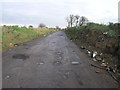
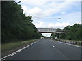
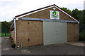
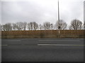
11 photos from this area
Area Information
Key information about the PE4 7DQ including its size, population, and administrative classification.
- Area Type
- Postcode
- Area Size
- 9326 m²
- Population
- 1693
- Population Density
- 5615 people/km²
House Prices in PE4 7DQ
27
Properties
£143,819
Average Sold Price
£37,995
Lowest Price
£300,000
Highest Price
Showing 27 properties
| Address | Type | Beds | Baths | Last Sale Price | Last Sale Date | |
|---|---|---|---|---|---|---|
| 55 Chadburn, Paston, Peterborough, PE4 7DQ | house | 4 | - | £165,000 | Jun 2025 | |
| 68 Chadburn, Paston, Peterborough, PE4 7DQ | house | - | - | £190,000 | May 2024 | |
| 57 Chadburn, Paston, Peterborough, PE4 7DQ | Terraced | 4 | 2 | £180,000 | Mar 2024 | |
| 73 Chadburn, Paston, Peterborough, PE4 7DQ | house | - | - | £300,000 | Dec 2020 | |
| 66 Chadburn, Paston, Peterborough, PE4 7DQ | Terraced | 3 | 1 | £140,000 | Aug 2019 | |
| 69 Chadburn, Paston, Peterborough, PE4 7DQ | Terraced | 4 | 2 | £136,000 | Nov 2018 | |
| 65 Chadburn, Paston, Peterborough, PE4 7DQ | Terraced | 3 | 1 | £114,000 | Jul 2016 | |
| 70 Chadburn, Paston, Peterborough, PE4 7DQ | Terraced | 3 | 1 | £105,200 | Jun 2007 | |
| 56 Chadburn, Paston, Peterborough, PE4 7DQ | Terraced | 4 | 1 | £69,995 | Feb 2003 | |
| 63 Chadburn, Paston, Peterborough, PE4 7DQ | house | - | - | £37,995 | Feb 2000 |
Page 1 of 3
Energy Efficiency in PE4 7DQ
Amenities
Schools
| Rank | School | Type | Entry gender | Ages |
|---|
Explore more schools in this area
Go to Schools tabDemographics
Household Size
Family (3-5 people)
most common
Accommodation Type
Houses
most common
Tenure
29
majority
Ethnic Group
White
most common
Religion
N/A
most common
Household Composition
N/A
most common
Age
47
median
Adults (30-64 years)
most common
Household Deprivation
N/A
with no deprivation
NS-SEC
12
in Lower managerial occupations
Explore more demographic insights in this area
Go to Demographics tabPlanning
Planning Constraints
- Flood RiskPremium
- Ramsar Wetland SitesPremium
- Area of Outstanding Natural BeautyPremium
- Protected Nature ReservePremium
- Protected WoodlandPremium