Area Overview for PE38 9UF
Photos of PE38 9UF
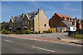
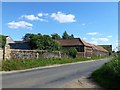
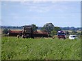
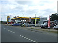
27 photos from this area
Area Information
Key information about the PE38 9UF including its size, population, and administrative classification.
- Area Type
- Postcode
- Area Size
- 1.2 hectares
- Population
- 1640
- Population Density
- 3271 people/km²
House Prices in PE38 9UF
15
Properties
£243,963
Average Sold Price
£124,000
Lowest Price
£367,000
Highest Price
Showing 15 properties
| Address | Type | Beds | Baths | Last Sale Price | Last Sale Date | |
|---|---|---|---|---|---|---|
| 8 Sage Avenue, Downham Market, PE38 9UF | Detached | 4 | 2 | £367,000 | Nov 2024 | |
| 9 Sage Avenue, Downham Market, PE38 9UF | Detached | 4 | 1 | £263,000 | Sep 2019 | |
| 10 Sage Avenue, Downham Market, PE38 9UF | house | 4 | 3 | £330,000 | Aug 2019 | |
| 3 Sage Avenue, Downham Market, PE38 9UF | Detached | 4 | - | £259,995 | Jul 2017 | |
| 5 Sage Avenue, Downham Market, PE38 9UF | house | - | - | £202,000 | Jul 2017 | |
| 13 Sage Avenue, Downham Market, PE38 9UF | Detached | 4 | - | £292,000 | Jan 2015 | |
| Sapphires, 11 Sage Avenue, Downham Market, PE38 9UF | house | 4 | - | £249,950 | Oct 2012 | |
| 6 Sage Avenue, Downham Market, PE38 9UF | Detached | 4 | 2 | £202,000 | Dec 2011 | |
| 14 Sage Avenue, Downham Market, PE38 9UF | Detached | 4 | 3 | £272,500 | Feb 2007 | |
| 15 Sage Avenue, Downham Market, PE38 9UF | Detached | - | - | £250,000 | Feb 2007 |
Page 1 of 2
Energy Efficiency in PE38 9UF
Amenities
Schools
| Rank | School | Type | Entry gender | Ages |
|---|
Explore more schools in this area
Go to Schools tabDemographics
Household Size
Family (3-5 people)
most common
Accommodation Type
Houses
most common
Tenure
54
majority
Ethnic Group
White
most common
Religion
N/A
most common
Household Composition
N/A
most common
Age
47
median
Adults (30-64 years)
most common
Household Deprivation
N/A
with no deprivation
NS-SEC
30
in Lower managerial occupations
Explore more demographic insights in this area
Go to Demographics tabPlanning
Planning Constraints
- Flood RiskPremium
- Ramsar Wetland SitesPremium
- Area of Outstanding Natural BeautyPremium
- Protected Nature ReservePremium
- Protected WoodlandPremium