Area Overview for PE38 0NR
Photos of PE38 0NR
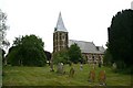
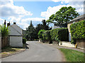

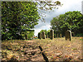
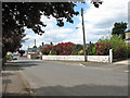

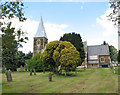
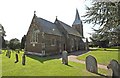
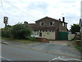
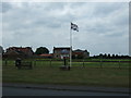
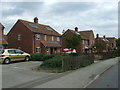
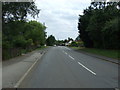
39 photos from this area
Area Information
Key information about the PE38 0NR including its size, population, and administrative classification.
- Area Type
- Postcode
- Area Size
- 16.9 hectares
- Population
- 1436
- Population Density
- 79 people/km²
House Prices in PE38 0NR
58
Properties
£211,141
Average Sold Price
£23,500
Lowest Price
£575,000
Highest Price
Showing 58 properties
| Address | Type | Beds | Baths | Last Sale Price | Last Sale Date | |
|---|---|---|---|---|---|---|
| Greenacres, 73 Feltwell Road, Southery, PE38 0NR | Detached | 3 | 2 | £575,000 | Nov 2024 | |
| 11 Feltwell Road, Southery, PE38 0NR | Semi-detached | 2 | 1 | £180,000 | Sep 2023 | |
| Rose Cottage, 49 Feltwell Road, Southery, PE38 0NR | Detached | 2 | 1 | £198,000 | Sep 2023 | |
| 29 Feltwell Road, Southery, PE38 0NR | Bungalow | 2 | 1 | £265,446 | Aug 2023 | |
| Topoth'ill, 33B Feltwell Road, Southery, PE38 0NR | Bungalow | 3 | 1 | £370,000 | Apr 2023 | |
| Southview, 55 Feltwell Road, Southery, PE38 0NR | Detached | 3 | 1 | £372,000 | Dec 2022 | |
| 45 Feltwell Road, Southery, PE38 0NR | house | 3 | 1 | £230,000 | Oct 2022 | |
| 35 Feltwell Road, Southery, PE38 0NR | Retail | 2 | 1 | £255,000 | Jul 2022 | |
| Mayfield, 91 Feltwell Road, Southery, PE38 0NR | Bungalow | - | - | £250,000 | Mar 2022 | |
| 41 Feltwell Road, Southery, PE38 0NR | house | 2 | - | £207,500 | Sep 2021 |
Page 1 of 6
Energy Efficiency in PE38 0NR
Amenities
Schools
| Rank | School | Type | Entry gender | Ages |
|---|
Explore more schools in this area
Go to Schools tabDemographics
Household Size
Two person
most common
Accommodation Type
Houses
most common
Tenure
68
majority
Ethnic Group
White
most common
Religion
N/A
most common
Household Composition
N/A
most common
Age
47
median
Adults (30-64 years)
most common
Household Deprivation
N/A
with no deprivation
NS-SEC
25
in Lower managerial occupations
Explore more demographic insights in this area
Go to Demographics tabPlanning
Planning Constraints
- Flood RiskPremium
- Ramsar Wetland SitesPremium
- Area of Outstanding Natural BeautyPremium
- Protected Nature ReservePremium
- Protected WoodlandPremium