Area Overview for PE38 0LL
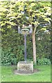
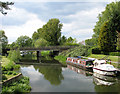
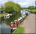
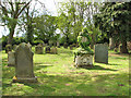
Photos of PE38 0LL
Area Information
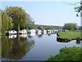
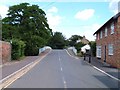
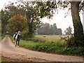
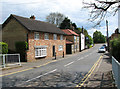
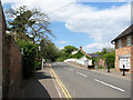
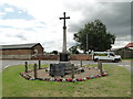
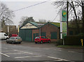
Living in PE38 0LL places you within the village limits of Hilgay, a civil parish located in the fenlands of Norfolk. This residential cluster has a population of 2,434 people, creating a tight-knit environment where neighbours often know one another. The area lies close to Ten Mile Bank and the River Great Ouse, offering a landscape that reflects its historical roots. The postcode covers a small stretch of accommodation characterised by spacious open land rather than high-density urban development. Historical records suggest Anglo-Saxon origins, with the name potentially deriving from Old English terms like "Hӯthla" or "Hydla". Nearby Downham Market, a Saxon settlement granted to Ramsey Abbey, sits at the heart of this local history. You will find remnants of Modney Priory, a former 13th-century Benedictine cell, within the parish boundaries. The village sits at coordinates 52.50919785199295, 0.33744955384892356, anchoring it firmly in the Eastern Region of England. Your daily life here revolves around the quiet rhythm of village living. While the specific local governance details for the CB7 and CB6 postcode areas sit just outside this specific boundary, the community feels distinctly separate due to its rural setting. This postcode serves as the gateway to a lifestyle defined by proximity to natural waterways and historical landmarks rather than city centres. The area offers a distinct escape from the hustle of larger towns while maintaining access to the wider network of Norfolk services.
- Area Type
- Postcode
- Area Size
- Not available
- Population
- 2434
- Population Density
- 39 people/km²
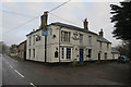
Homes in PE38 0LL are defined by a stock that is overwhelmingly owner-occupied. The data shows a home ownership level of 71 per cent, which is significantly higher than the rate found in many urban rental markets. Accommodation types are almost exclusively houses, reflecting the village character and the absence of high-density flats or tower blocks. This structure means that the property market here is driven by buyers looking to settle down rather than investors seeking short-term gains. You are likely to encounter properties with ample land, consistent with the fenland setting. The small size of the residential cluster creates a local market where supply is limited by the number of existing stock. This situation often leads to higher competition for desirable family homes when they come to the market. Buyers looking at this postcode should prepare for a market where rare finds are sought after. The prevalence of houses suggests that the area caters to families and couples who value space and privacy. There is little evidence of student accommodation or large blocks of social housing within this specific postcode boundary. The high ownership percentage indicates a community of people who have made a deliberate choice to live in Hilgay over their lives.
House Prices in PE38 0LL
No properties found in this postcode.
Energy Efficiency in PE38 0LL
Amenities
Schools
Families living in PE38 0LL have access to a range of educational options within practical reach. Ten Mile Bank Primary School is situated as a primary option for younger children. Denver Voluntary Controlled Primary School holds a Good Ofsted rating, providing a strong public education choice. Hilgay Village Voluntary Controlled Primary School serves the local village community. For secondary education, Hilgay Riverside Academy operates as an academy with a Good Ofsted rating. Ten Mile Bank Riverside Academy also serves the local area as an academy provision. This mix of primary and secondary academies ensures that families have diverse choices within the area. The presence of Good Ofsted rated institutions like Denver Voluntary Controlled Primary School and Hilgay Riverside Academy offers assurance of quality education. Schools near PE38 0LL allow parents to keep children within the local village network rather than commuting long distances. You will find that the educational provision supports the demographic of families with children in the 30 to 64 age bracket. The combination of controlled primary schools and academy secondary schools reflects a modern approach to local educational governance. This educational cluster makes the area viable for families who wish to keep their children close to home.
| Rank | School | Type | Entry gender | Ages |
|---|
Explore more schools in this area
Go to Schools tabDemographics
The community in PE38 0LL presents a mature profile with a median age of 47 years. The age range of adults between 30 and 64 years constitutes the most common demographic group within the village. Home ownership stands at a strong 71 per cent of households, indicating that the majority of residents have bought their homes rather than renting. Most people living in this area occupy houses, which aligns with the rural vernacular of the fenlands. The predominant ethnic group is White, reflecting the traditional composition of the region. This high rate of home ownership suggests stability within the neighbourhood. Families looking at homes in PE38 0LL will find an environment dominated by long-term residents. The demographic mix implies a community with significant disposable income and a preference for permanent tenures. There are no indicators of rapid population turnover or transient lifestyles in the neighbourhood data. The presence of adults in the 30 to 64 bracket suggests that many families have children or are in the prime working years. You can expect a population where residents are likely to be involved in local governance or village societies rather than living a transient lifestyle. The low population density of 39 people per square kilometre further reinforces the spacious feel of living here.
Household Size
Accommodation Type
Tenure
Ethnic Group
Religion
Household Composition
Age
Household Deprivation
NS-SEC
Explore more demographic insights in this area
Go to Demographics tabPlanning
Planning Constraints
- Flood RiskPremium
- Ramsar Wetland SitesPremium
- Area of Outstanding Natural BeautyPremium
- Protected Nature ReservePremium
- Protected WoodlandPremium