Area Overview for PE37 8BP
Photos of PE37 8BP
Area Information
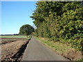
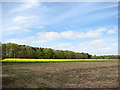
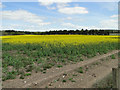
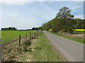
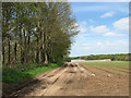
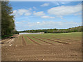
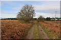
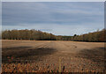
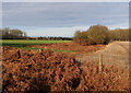
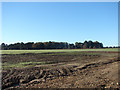
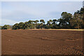
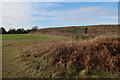
Living in PE37 8BP defines a specific residential experience within Norfolk. This postcode covers a small residential cluster comprising just 3.7 square kilometres. You are looking at a neighbourhood supported by a population of 2,101 residents. The density is low, averaging 20 people per square kilometre. This low figure means you will find a quiet environment rather than a busy urban street scene. The area functions as a defined pocket of housing within the wider Postcode PE37 region. The structure of the community is tight and localised. You will experience daily life where neighbours likely know one another. The setting is rural enough to offer space but connected enough to access larger towns. Your routine will centre on a small footprint that keeps travel distances short. The housing stock is concentrated within these few square kilometres. This layout suits those who prefer a defined boundary for their home life. You avoid the sprawl of unmanaged growth in favour of a contained community. The postcode serves as a precise identifier for this specific cluster. It tells a story of a place defined by its size and its people.
- Area Type
- Postcode
- Area Size
- 3.7 km²
- Population
- 2101
- Population Density
- 20 people/km²
The property market in PE37 8BP is dominated by owner-occupiers. Sixty-six per cent of residents own their homes outright or with a mortgage. This figure confirms the area as a genuine residential hub for people who buy property. Houses are the primary accommodation type you will encounter. You will struggle to find flats or purpose-built apartments. This absence of rental stock means the market is not geared towards transient tenants. When you look for homes in PE37 8BP, you are entering a space where long-term residents live. The small size of the postcode area, covering only 3.7 square kilometres, limits the total number of properties available. Competition may arise when sellers decide to move. The high ownership rate suggests property values are anchored by local sentiment. You are unlikely to find luxury developments or student housing schemes. The market reflects a traditional desire for single-family homes. Buyers should focus on detached or semi-detached properties. Supply is fixed by the physical constraints of the land. The character of the market is one of permanence and stability.
House Prices in PE37 8BP
Showing 2 properties
| Address | Type | Beds | Baths | Last Sale Price | Last Sale Date | |
|---|---|---|---|---|---|---|
| Rowley Farm, Brandon Road, Cockley Cley, PE37 8BP | Farm | - | - | - | - | |
| South Lodge, Cockley Cley Road, Cockley Cley, PE37 8BP | Detached | - | - | - | - |
Energy Efficiency in PE37 8BP
Your daily lifestyle in PE37 8BP revolves around a few key retail venues within easy reach. Five specific shops serve the local community. Iceland Swaffham provides groceries for your weekly shopping. Asda Swaffham is another major supermarket option nearby. Morrisons Daily Swaffham 49/51 offers convenience and essential goods. These three venues form the backbone of your local retail network. They are located in Swaffham, which is in practical reach of your home. You do not live within the immediate street frontage of these shops but they are accessible. This arrangement means you drive a short distance for fresh food and daily essentials. The range of amenities is limited to these five noted retailers. You will not find a local high street with cafés, banks, or larger department stores within the immediate cluster. Leisure facilities and parks are not detailed in the available data. Your trip planning must factor in travel to Swaffham for comprehensive services. The retail environment is functional rather than varied. You will complete most of your essential shopping with these specific stores.
Amenities
Schools
You have several primary school options within practical reach of PE37 8BP. Beachamwell First School stands ready as a local education provider. Gooderstone Church of England Voluntary Aided Primary School is situated nearby. Great Cressingham VC Primary School is another option for families in your quest for schools near PE37 8BP. Gooderstone Church of England Primary Academy also serves the area and holds a Good rating from Ofsted. This designation confirms the school meets high standards of education. You will find mostly primary institutions, indicating the area draws school-age children from the immediate neighbourhood. There are no secondary schools listed within this specific data set for the postcode. Your children may need to travel to a larger town for secondary education. The presence of multiple primary choices gives families flexibility when selecting the right setting. You can choose between the Church of England affiliations or the VC status. Gooderstone appears twice in the list, once with a rating and once as the academy name, suggesting a specific institution of note. The school profile is predominantly faith-based and village-focused.
| Rank | School | Type | Entry gender | Ages |
|---|
Explore more schools in this area
Go to Schools tabDemographics
The community in PE37 8BP skews towards mature living. The median age is 47 years old. Most residents fall into the adult age range between 30 and 64 years. This profile suggests a neighbourhood occupied by established households rather than young families or students. Home ownership stands at a high rate of 66 per cent. You are statistically more likely to purchase a home here than to rent one. This level of ownership indicates financial stability among the local population. Houses form the predominant type of accommodation. You will find fewer flats or high-density blocks. The ethnic makeup is predominantly White, reflecting the typical demographic of the region. This homogeneity often correlates with a shared cultural expectation for the neighbourhood. The area does not show signs of rapid demographic shift. The population structure remains consistent with a settled community. Families and individuals in their middle years form the core. The lack of high density means each household has significant space. This demographic makeup creates a stable social fabric.
Household Size
Accommodation Type
Tenure
Ethnic Group
Religion
Household Composition
Age
Household Deprivation
NS-SEC
Explore more demographic insights in this area
Go to Demographics tabPlanning
Planning Constraints
- Flood RiskPremium
- Ramsar Wetland SitesPremium
- Area of Outstanding Natural BeautyPremium
- Protected Nature ReservePremium
- Protected WoodlandPremium