Area Overview for PE34 4ST
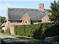
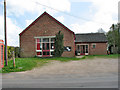
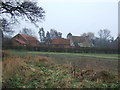
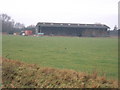
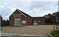
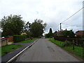
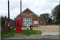
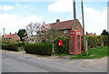
Photos of PE34 4ST
Area Information
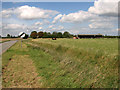
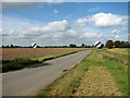
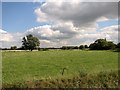
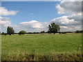
Living in PE34 4ST offers a quiet residential experience within a defined postcode cluster in England. This small community numbers 1,694 residents across an area with a population density of 87 people per square kilometre. You will find a settled environment where daily life revolves around proximity to larger towns rather than immediate urban density. The locality functions as a focused residential hub, distinct from the wider Kings Lynn area yet connected by essential transport links. Your days here involve a rhythm suited to those seeking calm over city bustle. The combination of low floor space per person and moderate density creates a neighbourhood where neighbours are within easy reach without the noise of high-rise living. This postcode serves as a gateway for families and professionals who prioritise established communities over rapid urban development. You can rely on known infrastructure for your weekly routines, from accessing local services to reaching major transport hubs. The area's character is defined by its stability and its role as a supportive base for households seeking a peaceful but accessible location in the East of England.
- Area Type
- Postcode
- Area Size
- Not available
- Population
- 1694
- Population Density
- 87 people/km²
The property market in PE34 4ST is overwhelmingly characterised by owner-occupation and traditional housing stock. With 85% home ownership, the area is distinctly different from urban centres where private landlords dominate the rental scene. This high rate suggests that most properties have been held by families for significant periods, often resulting in well-maintained buildings that support long-term residents. Homes in PE34 4ST are exclusively houses. You will not find purpose-built flats or high-density blocks within this specific cluster. This housing type typically offers more garden space and physical separation between neighbours, suiting those who prefer independence over the convenience of shared entrances. The prevalence of houses combined with high ownership rates means that the local economy relies heavily on the stability of the homeowner market. As a buyer, you are entering an environment where resale markets tend to be slower-moving but potentially more predictable, driven by owner decisions rather than speculative investment or short-term letting strategies.
House Prices in PE34 4ST
No properties found in this postcode.
Energy Efficiency in PE34 4ST
Your daily life in PE34 4ST is supported by a practical range of amenities within easy reach. Retail needs are covered by five local outlets, including Co-op Terrington, Morrisons Daily, and M& S Kings. These shops provide straightforward access to groceries and essentials without the need for long drives. Transport and leisure options extend slightly beyond the immediate cluster. You have access to two railway stations, Kings Lynn Railway Station and Watlington Railway Station, facilitating trips to York and Newcastle. Ferry facilities are available at West Lynn Ferry Landing and King's Lynn Ferry Landing for those requiring aquatic transport or coastal travel. While PE34 4ST itself is residential, these nearby amenities integrate seamlessly into your weekly routine. The combination of local retail and regional transport hubs means you can manage everyday shopping needs locally while retaining the flexibility to travel to larger towns for specialised services or entertainment.
Amenities
Schools
Families living in PE34 4ST benefit from access to several named educational institutions nearby. Tilney All Saints Voluntary Controlled Primary School serves as a key local option for younger children. Another choice is Tilney All Saints CofE Primary School, which holds a 'good' Ofsted rating, indicating strong educational standards. For children with special educational needs, Lovells Hall provides specialist support within the community catchment. This mix of school types ensures that residents have choices ranging from standard primary education to special needs provision. The presence of a rated school alongside voluntary controlled and specialist institutions suggests a comprehensive local network. You do not need to travel far to secure education for your children, as the named schools are situated close to the residential cluster. These institutions support the local demographic, which consists largely of children and young adults within the 30 to 64 year-old working population. The availability of these specific schools removes the need to consider external districts for primary and secondary education needs.
| Rank | School | Type | Entry gender | Ages |
|---|
Explore more schools in this area
Go to Schools tabDemographics
The community in PE34 4ST is defined by a mature and stable demographic profile. Residents in this area average a median age of 47 years, reflecting a population where adults aged between 30 and 64 years are the most common age group. This indicates a community of established households rather than a transient student or young professional enclave. You are likely to meet neighbours who have put down roots, contributing to a consistent social fabric. Home ownership is extremely prevalent, with 85% of the local population owning their homes outright or with a mortgage. This statistic signals long-term settlement and financial stability within the postcode. Virtually all accommodation takes the form of houses, meaning you will see terraced or semi-detached family dwellings rather than apartments or rental flats. The area is also predominantly White, aligning with the broader demographic trends of rural and semi-rural England. This homogeneity in age and tenure suggests a neighbourhood where the same families have lived for generations, creating deep local knowledge networks and consistent community standards.
Household Size
Accommodation Type
Tenure
Ethnic Group
Religion
Household Composition
Age
Household Deprivation
NS-SEC
Explore more demographic insights in this area
Go to Demographics tabPlanning
Planning Constraints
- Flood RiskPremium
- Ramsar Wetland SitesPremium
- Area of Outstanding Natural BeautyPremium
- Protected Nature ReservePremium
- Protected WoodlandPremium