Area Overview for PE34 4NR
Photos of PE34 4NR


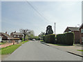
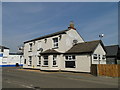
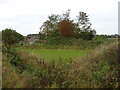
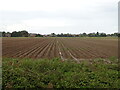
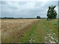
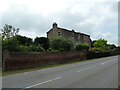

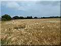
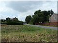
24 photos from this area
Area Information
Key information about the PE34 4NR including its size, population, and administrative classification.
- Area Type
- Postcode
- Area Size
- 4.6 hectares
- Population
- 1879
- Population Density
- 775 people/km²
House Prices in PE34 4NR
21
Properties
£225,600
Average Sold Price
£90,500
Lowest Price
£400,000
Highest Price
Showing 21 properties
| Address | Type | Beds | Baths | Last Sale Price | Last Sale Date | |
|---|---|---|---|---|---|---|
| 14 Wanton Lane, Terrington St Clement, PE34 4NR | Bungalow | 2 | 1 | £345,000 | Mar 2022 | |
| 33 Wanton Lane, Terrington St Clement, PE34 4NR | Detached | 4 | 1 | £350,000 | Nov 2020 | |
| Kimberley, 29 Wanton Lane, Terrington St Clement, PE34 4NR | Detached | 4 | 2 | £400,000 | Nov 2017 | |
| 31 Wanton Lane, Terrington St Clement, PE34 4NR | house | - | - | £125,000 | Jun 2017 | |
| 23 Wanton Lane, Terrington St Clement, PE34 4NR | Cottage | 2 | 1 | £147,000 | Sep 2016 | |
| Well Cottage, 19 Wanton Lane, Terrington St Clement, PE34 4NR | house | 2 | - | £124,000 | Aug 2015 | |
| 1A Wanton Lane, Terrington St Clement, PE34 4NR | house | - | - | £215,000 | Dec 2010 | |
| 15 Wanton Lane, Terrington St Clement, PE34 4NR | house | - | - | £90,500 | Aug 2009 | |
| 21 Wanton Lane, Terrington St Clement, PE34 4NR | Terraced | - | - | £124,500 | Apr 2008 | |
| Ash House, 17 Wanton Lane, Terrington St Clement, PE34 4NR | Detached | - | - | £335,000 | Jun 2007 |
Page 1 of 3
Energy Efficiency in PE34 4NR
Amenities
Schools
| Rank | School | Type | Entry gender | Ages |
|---|
Explore more schools in this area
Go to Schools tabDemographics
Household Size
Two person
most common
Accommodation Type
Houses
most common
Tenure
80
majority
Ethnic Group
White
most common
Religion
N/A
most common
Household Composition
N/A
most common
Age
47
median
Adults (30-64 years)
most common
Household Deprivation
N/A
with no deprivation
NS-SEC
27
in Lower managerial occupations
Explore more demographic insights in this area
Go to Demographics tabPlanning
Planning Constraints
- Flood RiskPremium
- Ramsar Wetland SitesPremium
- Area of Outstanding Natural BeautyPremium
- Protected Nature ReservePremium
- Protected WoodlandPremium