Area Overview for PE34 3QH
Photos of PE34 3QH
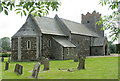

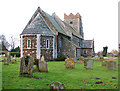
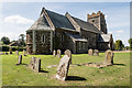
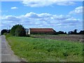
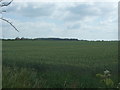
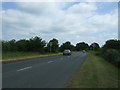
29 photos from this area
Area Information
Key information about the PE34 3QH including its size, population, and administrative classification.
- Area Type
- Postcode
- Area Size
- 4.6 hectares
- Population
- 2602
- Population Density
- 40 people/km²
House Prices in PE34 3QH
28
Properties
£131,063
Average Sold Price
£40,000
Lowest Price
£190,000
Highest Price
Showing 28 properties
| Address | Type | Beds | Baths | Last Sale Price | Last Sale Date | |
|---|---|---|---|---|---|---|
| 9 Chapel Lane, Wimbotsham, PE34 3QH | Detached | 3 | - | £190,000 | Feb 2019 | |
| 17 Chapel Lane, Wimbotsham, PE34 3QH | Semi-detached | 3 | - | £172,000 | Dec 2018 | |
| 1 Chapel Lane, Wimbotsham, PE34 3QH | Semi-detached | 3 | 2 | £167,500 | Nov 2017 | |
| 14 Chapel Lane, Wimbotsham, PE34 3QH | house | - | - | £155,000 | Jul 2009 | |
| 7 Chapel Lane, Wimbotsham, PE34 3QH | Semi-detached | 3 | 1 | £145,000 | Dec 2006 | |
| Chapel Cottage, 27 Chapel Lane, Wimbotsham, PE34 3QH | Detached | - | - | £52,500 | Dec 2003 | |
| High View, 28 Chapel Lane, Wimbotsham, PE34 3QH | Detached | - | - | £126,500 | Nov 2001 | |
| 22-24 Chapel Lane, Wimbotsham, PE34 3QH | Semi-detached | - | - | £40,000 | Mar 1996 | |
| 20 Chapel Lane, Wimbotsham, PE34 3QH | Detached | 3 | 1 | - | - | |
| 15 Chapel Lane, Wimbotsham, PE34 3QH | Detached | 3 | - | - | - |
Page 1 of 3
Energy Efficiency in PE34 3QH
Amenities
Schools
| Rank | School | Type | Entry gender | Ages |
|---|
Explore more schools in this area
Go to Schools tabDemographics
Household Size
Two person
most common
Accommodation Type
Houses
most common
Tenure
74
majority
Ethnic Group
White
most common
Religion
N/A
most common
Household Composition
N/A
most common
Age
47
median
Adults (30-64 years)
most common
Household Deprivation
N/A
with no deprivation
NS-SEC
32
in Lower managerial occupations
Explore more demographic insights in this area
Go to Demographics tabPlanning
Planning Constraints
- Flood RiskPremium
- Ramsar Wetland SitesPremium
- Area of Outstanding Natural BeautyPremium
- Protected Nature ReservePremium
- Protected WoodlandPremium