Area Overview for PE34 3LJ
Photos of PE34 3LJ
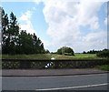
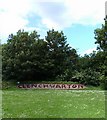
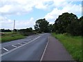
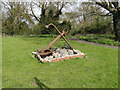
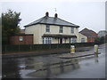

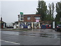
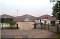
33 photos from this area
Area Information
Key information about the PE34 3LJ including its size, population, and administrative classification.
- Area Type
- Postcode
- Area Size
- 5.4 hectares
- Population
- 1797
- Population Density
- 507 people/km²
House Prices in PE34 3LJ
14
Properties
£90,857
Average Sold Price
£24,000
Lowest Price
£147,000
Highest Price
Showing 14 properties
| Address | Type | Beds | Baths | Last Sale Price | Last Sale Date | |
|---|---|---|---|---|---|---|
| 129 Clenchwarton Road, West Lynn, Kings Lynn, PE34 3LJ | Cottage | 2 | 1 | £147,000 | Mar 2019 | |
| 103 Clenchwarton Road, West Lynn, Kings Lynn, PE34 3LJ | Terraced | 3 | 1 | £107,500 | Jun 2014 | |
| 101 Clenchwarton Road, West Lynn, Kings Lynn, PE34 3LJ | Terraced | 2 | 1 | £95,000 | Feb 2013 | |
| 107 Clenchwarton Road, West Lynn, Kings Lynn, PE34 3LJ | Terraced | 2 | 1 | £102,500 | Apr 2007 | |
| 127 Clenchwarton Road, West Lynn, Kings Lynn, PE34 3LJ | Detached | - | - | £128,500 | Jun 2002 | |
| 117 Clenchwarton Road, West Lynn, Kings Lynn, PE34 3LJ | house | - | - | £24,000 | Jul 2000 | |
| 105 Clenchwarton Road, West Lynn, Kings Lynn, PE34 3LJ | Terraced | - | - | £31,500 | Oct 1998 | |
| 109 Clenchwarton Road, West Lynn, Kings Lynn, PE34 3LJ | Chalet | 4 | 2 | - | - | |
| 113 Clenchwarton Road, West Lynn, Kings Lynn, PE34 3LJ | Cottage | 2 | 1 | - | - | |
| Horseshoe Cottage, 115 Clenchwarton Road, West Lynn, Kings Lynn, PE34 3LJ | Terraced | 3 | 1 | - | - |
Page 1 of 2
Energy Efficiency in PE34 3LJ
Amenities
Schools
| Rank | School | Type | Entry gender | Ages |
|---|
Explore more schools in this area
Go to Schools tabDemographics
Household Size
Family (3-5 people)
most common
Accommodation Type
Houses
most common
Tenure
72
majority
Ethnic Group
White
most common
Religion
N/A
most common
Household Composition
N/A
most common
Age
47
median
Adults (30-64 years)
most common
Household Deprivation
N/A
with no deprivation
NS-SEC
23
in Lower managerial occupations
Explore more demographic insights in this area
Go to Demographics tabPlanning
Planning Constraints
- Flood RiskPremium
- Ramsar Wetland SitesPremium
- Area of Outstanding Natural BeautyPremium
- Protected Nature ReservePremium
- Protected WoodlandPremium