Area Overview for PE33 9TA
Photos of PE33 9TA


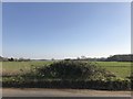

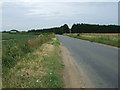
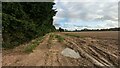
9 photos from this area
Area Information
Key information about the PE33 9TA including its size, population, and administrative classification.
- Area Type
- Postcode
- Area Size
- 31.5 hectares
- Population
- 2559
- Population Density
- 92 people/km²
House Prices in PE33 9TA
36
Properties
£257,430
Average Sold Price
£47,195
Lowest Price
£700,000
Highest Price
Showing 36 properties
| Address | Type | Beds | Baths | Last Sale Price | Last Sale Date | |
|---|---|---|---|---|---|---|
| Hope Cottage, Oxborough Road, Stoke Ferry, PE33 9TA | Detached | 2 | 1 | £170,000 | Aug 2025 | |
| 63 Oxborough Road, Stoke Ferry, PE33 9TA | Detached | 4 | 2 | £510,000 | Jul 2025 | |
| 55 Oxborough Road, Stoke Ferry, PE33 9TA | Semi-detached | 3 | 2 | £335,000 | Jan 2025 | |
| The Old Shop, Oxborough Road, Stoke Ferry, PE33 9TA | Detached | 3 | 1 | £340,000 | Nov 2024 | |
| 6 Oxborough Road, Stoke Ferry, PE33 9TA | Terraced | 4 | 2 | £168,000 | Aug 2023 | |
| Sycamore House, Oxborough Road, Stoke Ferry, PE33 9TA | house | - | - | £700,000 | Aug 2022 | |
| 61 Oxborough Road, Stoke Ferry, PE33 9TA | house | - | - | £480,000 | Sep 2021 | |
| Appletree Cottage, 9 Oxborough Road, Stoke Ferry, PE33 9TA | house | - | - | £200,000 | Nov 2020 | |
| 10 Oxborough Road, Stoke Ferry, PE33 9TA | house | - | - | £153,000 | Jul 2019 | |
| 67 Oxborough Road, Stoke Ferry, PE33 9TA | house | - | - | £389,950 | May 2019 |
Page 1 of 4
Energy Efficiency in PE33 9TA
Amenities
Schools
| Rank | School | Type | Entry gender | Ages |
|---|
Explore more schools in this area
Go to Schools tabDemographics
Household Size
Two person
most common
Accommodation Type
Houses
most common
Tenure
76
majority
Ethnic Group
White
most common
Religion
N/A
most common
Household Composition
N/A
most common
Age
47
median
Adults (30-64 years)
most common
Household Deprivation
N/A
with no deprivation
NS-SEC
30
in Lower managerial occupations
Explore more demographic insights in this area
Go to Demographics tabPlanning
Planning Constraints
- Flood RiskPremium
- Ramsar Wetland SitesPremium
- Area of Outstanding Natural BeautyPremium
- Protected Nature ReservePremium
- Protected WoodlandPremium