Area Overview for PE33 9SQ
Photos of PE33 9SQ
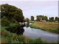
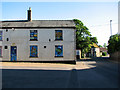
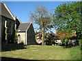


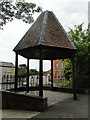
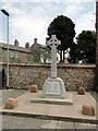
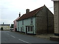
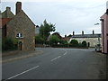
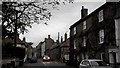
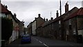
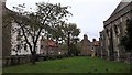
56 photos from this area
Area Information
Key information about the PE33 9SQ including its size, population, and administrative classification.
- Area Type
- Postcode
- Area Size
- 2.8 hectares
- Population
- 2559
- Population Density
- 92 people/km²
House Prices in PE33 9SQ
20
Properties
£196,864
Average Sold Price
£45,000
Lowest Price
£395,000
Highest Price
Showing 20 properties
| Address | Type | Beds | Baths | Last Sale Price | Last Sale Date | |
|---|---|---|---|---|---|---|
| 39 Wretton Road, Stoke Ferry, PE33 9SQ | Semi-detached | 3 | - | £200,000 | Sep 2021 | |
| The Bungalow, 29 Wretton Road, Stoke Ferry, PE33 9SQ | Bungalow | 3 | - | £235,000 | Mar 2020 | |
| Carnegie Lodge, 27 Wretton Road, Stoke Ferry, PE33 9SQ | Detached | 5 | 3 | £335,000 | Apr 2018 | |
| Sunset Cottage, 11 Wretton Road, Stoke Ferry, PE33 9SQ | house | - | - | £124,000 | Sep 2012 | |
| 37 Wretton Road, Stoke Ferry, PE33 9SQ | Bungalow | 4 | 2 | £195,000 | Jan 2012 | |
| Bewenjon, 33 Wretton Road, Stoke Ferry, PE33 9SQ | Bungalow | 3 | 1 | £195,000 | Dec 2011 | |
| Canterbury House, 7 Wretton Road, Stoke Ferry, PE33 9SQ | Detached | 4 | 3 | £395,000 | Jul 2010 | |
| Mon Ami, 35 Wretton Road, Stoke Ferry, PE33 9SQ | Bungalow | 3 | 2 | £184,000 | Apr 2007 | |
| Redroofs, 15 Wretton Road, Stoke Ferry, PE33 9SQ | Bungalow | - | - | £150,000 | Dec 2005 | |
| Council Bungalows, 41 Wretton Road, Stoke Ferry, PE33 9SQ | Detached | 1 | 1 | £107,500 | Nov 2003 |
Page 1 of 2
Energy Efficiency in PE33 9SQ
Amenities
Schools
| Rank | School | Type | Entry gender | Ages |
|---|
Explore more schools in this area
Go to Schools tabDemographics
Household Size
Two person
most common
Accommodation Type
Houses
most common
Tenure
76
majority
Ethnic Group
White
most common
Religion
N/A
most common
Household Composition
N/A
most common
Age
47
median
Adults (30-64 years)
most common
Household Deprivation
N/A
with no deprivation
NS-SEC
30
in Lower managerial occupations
Explore more demographic insights in this area
Go to Demographics tabPlanning
Planning Constraints
- Flood RiskPremium
- Ramsar Wetland SitesPremium
- Area of Outstanding Natural BeautyPremium
- Protected Nature ReservePremium
- Protected WoodlandPremium