Area Overview for PE33 9QJ
Photos of PE33 9QJ
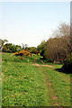
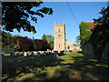
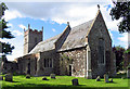

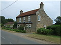

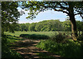

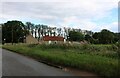
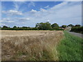
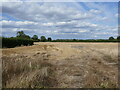
20 photos from this area
Area Information
Key information about the PE33 9QJ including its size, population, and administrative classification.
- Area Type
- Postcode
- Area Size
- 24.4 hectares
- Population
- 2559
- Population Density
- 92 people/km²
House Prices in PE33 9QJ
24
Properties
£332,000
Average Sold Price
£60,000
Lowest Price
£575,000
Highest Price
Showing 24 properties
| Address | Type | Beds | Baths | Last Sale Price | Last Sale Date | |
|---|---|---|---|---|---|---|
| Field View, 72 Wretton Road, Stoke Ferry, PE33 9QJ | Bungalow | 3 | 2 | £320,000 | Nov 2025 | |
| Oak Farm House, 48 Wretton Road, Stoke Ferry, PE33 9QJ | Detached | 5 | 2 | £440,000 | Sep 2025 | |
| Bramley End, 66 Wretton Road, Stoke Ferry, PE33 9QJ | Bungalow | 3 | 2 | £355,000 | Oct 2023 | |
| Cherrycroft, 68 Wretton Road, Stoke Ferry, PE33 9QJ | Bungalow | 3 | 2 | £350,000 | May 2023 | |
| Manor House, 54 Wretton Road, Stoke Ferry, PE33 9QJ | Semi-detached | 5 | 2 | £575,000 | Aug 2022 | |
| Bradfield Lodge, 69 Wretton Road, Stoke Ferry, PE33 9QJ | Detached | 4 | - | £530,000 | Jan 2022 | |
| The Old School, 71 Wretton Road, Stoke Ferry, PE33 9QJ | Bungalow | 3 | - | £350,000 | May 2018 | |
| Manor Cottage, 50 Wretton Road, Stoke Ferry, PE33 9QJ | Detached | 5 | 2 | £355,000 | May 2018 | |
| The School House, 73 Wretton Road, Stoke Ferry, PE33 9QJ | Detached | 3 | - | £235,000 | Dec 2015 | |
| Acacia House, 56 Wretton Road, Stoke Ferry, PE33 9QJ | house | - | - | £149,000 | Aug 2001 |
Page 1 of 3
Energy Efficiency in PE33 9QJ
Amenities
Schools
| Rank | School | Type | Entry gender | Ages |
|---|
Explore more schools in this area
Go to Schools tabDemographics
Household Size
Two person
most common
Accommodation Type
Houses
most common
Tenure
76
majority
Ethnic Group
White
most common
Religion
N/A
most common
Household Composition
N/A
most common
Age
47
median
Adults (30-64 years)
most common
Household Deprivation
N/A
with no deprivation
NS-SEC
30
in Lower managerial occupations
Explore more demographic insights in this area
Go to Demographics tabPlanning
Planning Constraints
- Flood RiskPremium
- Ramsar Wetland SitesPremium
- Area of Outstanding Natural BeautyPremium
- Protected Nature ReservePremium
- Protected WoodlandPremium