Area Overview for PE33 9JP
Photos of PE33 9JP
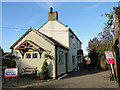
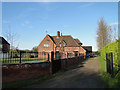
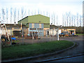
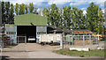
13 photos from this area
Area Information
Key information about the PE33 9JP including its size, population, and administrative classification.
- Area Type
- Postcode
- Area Size
- 60.5 hectares
- Population
- 1838
- Population Density
- 165 people/km²
House Prices in PE33 9JP
32
Properties
£229,425
Average Sold Price
£40,000
Lowest Price
£437,500
Highest Price
Showing 32 properties
| Address | Type | Beds | Baths | Last Sale Price | Last Sale Date | |
|---|---|---|---|---|---|---|
| Arrandale, The Street, Marham, PE33 9JP | Bungalow | 3 | 2 | £272,500 | Mar 2025 | |
| Hazelwell, The Street, Marham, PE33 9JP | Bungalow | 3 | - | £310,000 | Jul 2021 | |
| 5 The Street, Marham, PE33 9JP | house | - | - | £200,000 | Jul 2021 | |
| Davanmor, The Street, Marham, PE33 9JP | Bungalow | 4 | 2 | £320,000 | Dec 2020 | |
| Kismet, The Street, Marham, PE33 9JP | Semi-detached | 4 | 1 | £129,000 | Oct 2019 | |
| Janpari, The Street, Marham, PE33 9JP | Detached | - | - | £315,000 | Sep 2018 | |
| Leylandii, The Street, Marham, PE33 9JP | Bungalow | 3 | 1 | £325,000 | Aug 2018 | |
| Meadow View, The Street, Marham, PE33 9JP | Detached | - | - | £40,000 | Oct 2017 | |
| The Satchet, The Street, Marham, PE33 9JP | Detached | 4 | 2 | £245,000 | Jul 2017 | |
| 6 The Street, Marham, PE33 9JP | Detached | 3 | 2 | £189,000 | Jun 2016 |
Page 1 of 4
Energy Efficiency in PE33 9JP
Amenities
Schools
| Rank | School | Type | Entry gender | Ages |
|---|
Explore more schools in this area
Go to Schools tabDemographics
Household Size
Family (3-5 people)
most common
Accommodation Type
Houses
most common
Tenure
22
majority
Ethnic Group
White
most common
Religion
N/A
most common
Household Composition
N/A
most common
Age
22
median
Adults (30-64 years)
most common
Household Deprivation
N/A
with no deprivation
NS-SEC
46
in Lower managerial occupations
Explore more demographic insights in this area
Go to Demographics tabPlanning
Planning Constraints
- Ramsar Wetland SitesPremium
- Area of Outstanding Natural BeautyPremium
- Protected Nature ReservePremium