Area Overview for PE33 0SG
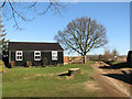
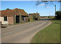
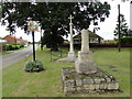
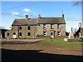
Photos of PE33 0SG

Area Information
Living in PE33 0SG offers a distinct experience within a small residential cluster covering 2.7 square kilometres. This postcode area accommodates a population of 1,384 people, resulting in a low density of approximately 37 residents per square kilometre. You will find a community where space is abundant and the local character is defined by quiet streets rather than urban bustle. The area serves as a compact residential hub, ideal for those seeking a slower pace of life without complete isolation. Daily routines revolve around local necessities and short commutes to nearby towns. The physical layout supports a contained lifestyle where neighbours are often within walking distance of each other. You are situated in a setting that prioritises calm over convenience, making it a practical choice for owners who value room and privacy. The small footprint means that development options are naturally limited, preserving the current residential nature of the postcode. Prospective buyers looking for a specific, manageable environment will recognise this scale as a key feature rather than a limitation.
- Area Type
- Postcode
- Area Size
- 2.7 km²
- Population
- 1384
- Population Density
- 37 people/km²
The housing market in PE33 0SG is characterised by a property base almost entirely focused on owner-occupation. With 74 per cent of residential units occupied by homeowners, rental turnover remains comparatively low. Houses dominate the stock, distinguishing this postcode from areas where flats or apartments define the skyline. This market structure means buyers often engage with existing owners rather than landlords managing portfolios. The small total population of 1,384 residents places limits on property supply, as the residential cluster covers only 2.7 square kilometres. Volume is scarce, but this scarcity aligns with the preference for house ownership found here. You can expect a market where properties change hands through private sales between knowledgeable buyers. The accommodation type data confirms that you are looking at traditional UK housing forms. There is no significant presence of purpose-built rental blocks. Consequently, your primary focus will be on individual houses within a established owner-occupier community.
House Prices in PE33 0SG
Showing 58 properties
| Address | Type | Beds | Baths | Last Sale Price | Last Sale Date | |
|---|---|---|---|---|---|---|
| Nar View, Castle Road, Wormegay, PE33 0SG | Detached | 4 | 3 | £450,000 | May 2025 | |
| Sellarus, Castle Road, Wormegay, PE33 0SG | Detached | 4 | 2 | £425,000 | Mar 2025 | |
| Stratton Cottage, Castle Road, Wormegay, PE33 0SG | Cottage | 3 | 2 | £340,000 | Mar 2023 | |
| The Keep, Castle Road, Wormegay, PE33 0SG | Detached | 4 | - | £500,000 | Oct 2022 | |
| Ladysmith Cottage, Castle Road, Wormegay, PE33 0SG | house | - | - | £270,000 | Dec 2021 | |
| Forest View, Castle Road, Wormegay, PE33 0SG | house | - | - | £385,000 | Apr 2021 | |
| Honeydukes, Castle Road, Wormegay, PE33 0SG | Detached | 4 | 2 | £370,000 | Nov 2020 | |
| Flintstones, Castle Road, Wormegay, PE33 0SG | Semi-detached | 3 | 1 | £147,500 | Oct 2019 | |
| Brook House, Castle Road, Wormegay, PE33 0SG | Semi-detached | 3 | - | £224,000 | Jun 2019 | |
| Beech House, Castle Road, Wormegay, PE33 0SG | Terraced | 2 | 2 | £144,000 | Feb 2019 |
Energy Efficiency in PE33 0SG
Your everyday convenience relies on a ring of retail and transport facilities located just outside the residential cluster. Within key travel distance, you access three railway stations: Watlington Railway Station, Kings Lynn Railway Station, and Downham Market Railway Station. These stations connect the postcode to wider regional transport networks. Local shopping trips benefit from three major supermarkets: Iceland Kings, Sainsburys Kings, and Tesco Kings. These retailers are established in nearby Kings, ensuring you have access to fresh food and household essentials without travelling far. One notable transport feature is the Kings Lynn Ferry Landing, which adds a unique waterborne connection to the region. An airport presence is also noted via RAF Marham, though this serves a specific logistical rather than commercial passenger role. The retail count of five indicates a modest but functional strip of high-street commerce. You will not find extensive leisure parks or large cultural venues immediately adjacent to the homes. Your lifestyle centres on practical access to essential goods and regional rail links rather than city-centre amenities.
Amenities
Schools
Families considering homes in PE33 0SG have access to a diverse mix of educational institutions within practical reach. Primary education is well catered for, with Wormegay Church of England Primary School and Runcton Holme Church of England Primary School serving different clusters of pupils. Holy Cross Church of England Primary School holds a good Ofsted rating, providing a benchmark for quality education in the vicinity. You also find The Old Mill House School, an independent option for those seeking private education pathways. The presence of multiple primary schools indicates that children in the area can enrol in different settings based on catchment boundaries. This variety ensures that residents are not reliant on a single institution for their children's education. School types range from state-funded faith schools to independent academies, offering choices for different educational philosophies. The proximity of these schools to PE33 0SG means that daily school runs remain short for most families.
| Rank | School | Type | Entry gender | Ages |
|---|
Explore more schools in this area
Go to Schools tabDemographics
The community profile of PE33 0SG reflects a mature, settled population with strong roots in the area. The median age stands at 47 years, placing the demographic centre firmly within the adult bracket of 30 to 64 years. This age distribution suggests a neighbourhood dominated by families and established households rather than young professionals or students. Over 74 per cent of residents own their homes, indicating a stable community with high tenure security. Houses constitute the predominant accommodation type, meaning you will contend largely with detached or semi-detached properties in your search. While the predominant ethnic group is White, the data highlights a generally homogenous social fabric. You will not find pockets of high transient population or young people under 16, which aligns with the older median age. This demographic structure creates a consistent environment where long-term residents manage the local pace of life. The high home ownership rate further reinforces a sense of permanence, as a large majority of households have a financial stake in maintaining their properties.
Household Size
Accommodation Type
Tenure
Ethnic Group
Religion
Household Composition
Age
Household Deprivation
NS-SEC
Explore more demographic insights in this area
Go to Demographics tabPlanning
Planning Constraints
- Flood RiskPremium
- Ramsar Wetland SitesPremium
- Area of Outstanding Natural BeautyPremium
- Protected Nature ReservePremium
- Protected WoodlandPremium