Area Overview for PE33 0RD
Photos of PE33 0RD
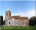
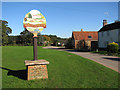


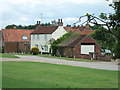


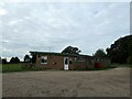
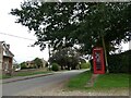
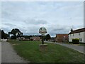


26 photos from this area
Area Information
Key information about the PE33 0RD including its size, population, and administrative classification.
- Area Type
- Postcode
- Area Size
- 13.3 hectares
- Population
- 1856
- Population Density
- 242 people/km²
House Prices in PE33 0RD
32
Properties
£323,361
Average Sold Price
£73,500
Lowest Price
£455,000
Highest Price
Showing 32 properties
| Address | Type | Beds | Baths | Last Sale Price | Last Sale Date | |
|---|---|---|---|---|---|---|
| Long Ridge, 6 Common Lane, North Runcton, PE33 0RD | Bungalow | 4 | 3 | £455,000 | Apr 2025 | |
| Rivendell, 35 Common Lane, North Runcton, PE33 0RD | Bungalow | 3 | 2 | £450,000 | Feb 2024 | |
| Burnhaven, 27 Common Lane, North Runcton, PE33 0RD | Retail | 3 | 1 | £385,000 | Mar 2022 | |
| Meadowgate House, Common Lane, North Runcton, PE33 0RD | Detached | 4 | - | £435,000 | Aug 2021 | |
| Gables Cottage, 9 Common Lane, North Runcton, PE33 0RD | Cottage | 3 | 1 | £295,000 | Feb 2020 | |
| Little Paddock, 45 Common Lane, North Runcton, PE33 0RD | Bungalow | 3 | 1 | £417,500 | Jun 2019 | |
| Willow Bank, 20 Common Lane, North Runcton, PE33 0RD | Terraced | 2 | 1 | £440,000 | Mar 2019 | |
| Southfields, 15 Common Lane, North Runcton, PE33 0RD | Detached | 4 | - | £380,000 | Oct 2018 | |
| 23 Common Lane, North Runcton, PE33 0RD | Bungalow | 3 | 1 | £227,500 | May 2017 | |
| Walnut House, 37 Common Lane, North Runcton, PE33 0RD | house | - | - | £340,000 | Oct 2016 |
Page 1 of 4
Energy Efficiency in PE33 0RD
Amenities
Schools
| Rank | School | Type | Entry gender | Ages |
|---|
Explore more schools in this area
Go to Schools tabDemographics
Household Size
Two person
most common
Accommodation Type
Houses
most common
Tenure
76
majority
Ethnic Group
White
most common
Religion
N/A
most common
Household Composition
N/A
most common
Age
47
median
Adults (30-64 years)
most common
Household Deprivation
N/A
with no deprivation
NS-SEC
30
in Lower managerial occupations
Explore more demographic insights in this area
Go to Demographics tabPlanning
Planning Constraints
- Flood RiskPremium
- Ramsar Wetland SitesPremium
- Area of Outstanding Natural BeautyPremium
- Protected Nature ReservePremium
- Protected WoodlandPremium