Area Overview for PE33 0JG
Photos of PE33 0JG
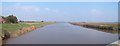
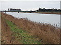
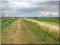
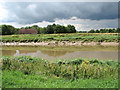
43 photos from this area
Area Information
Key information about the PE33 0JG including its size, population, and administrative classification.
- Area Type
- Postcode
- Area Size
- 1.4 km²
- Population
- 2594
- Population Density
- 379 people/km²
House Prices in PE33 0JG
20
Properties
£296,438
Average Sold Price
£50,500
Lowest Price
£720,000
Highest Price
Showing 20 properties
| Address | Type | Beds | Baths | Last Sale Price | Last Sale Date | |
|---|---|---|---|---|---|---|
| Station Farm, 125 Station Road, Watlington, PE33 0JG | Detached | 4 | 2 | £720,000 | Jul 2023 | |
| Willow Barn, 197 Station Road, Watlington, PE33 0JG | Detached | 5 | 2 | £475,000 | Nov 2018 | |
| 167 Station Road, Watlington, PE33 0JG | Bungalow | 2 | - | £146,500 | Aug 2014 | |
| Bramley Bungalow, 100 Station Road, Watlington, PE33 0JG | Bungalow | 3 | 1 | £322,500 | Nov 2013 | |
| The Hive, 173 Station Road, Watlington, PE33 0JG | Detached | - | - | £265,000 | Mar 2005 | |
| Holme Farm, 201 Station Road, Watlington, PE33 0JG | Detached | 4 | 2 | £250,000 | Oct 2002 | |
| Andel House, 211 Station Road, Watlington, PE33 0JG | Detached | - | - | £142,000 | Jul 2001 | |
| 181 Station Road, Watlington, PE33 0JG | Detached | - | - | £50,500 | Oct 1999 | |
| Toads Hole, 207 Station Road, Watlington, PE33 0JG | Chalet | 4 | 3 | - | - | |
| Willow Lodge, 199 Station Road, Watlington, PE33 0JG | Cottage | 3 | 1 | - | - |
Page 1 of 2
Energy Efficiency in PE33 0JG
Amenities
Schools
| Rank | School | Type | Entry gender | Ages |
|---|
Explore more schools in this area
Go to Schools tabDemographics
Household Size
Two person
most common
Accommodation Type
Houses
most common
Tenure
76
majority
Ethnic Group
White
most common
Religion
N/A
most common
Household Composition
N/A
most common
Age
47
median
Adults (30-64 years)
most common
Household Deprivation
N/A
with no deprivation
NS-SEC
31
in Lower managerial occupations
Explore more demographic insights in this area
Go to Demographics tabPlanning
Planning Constraints
- Flood RiskPremium
- Ramsar Wetland SitesPremium
- Area of Outstanding Natural BeautyPremium
- Protected Nature ReservePremium
- Protected WoodlandPremium