Area Overview for PE33 0HU
Photos of PE33 0HU

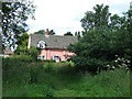
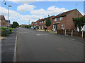
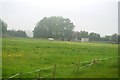
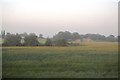

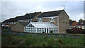
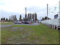
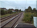
24 photos from this area
Area Information
Key information about the PE33 0HU including its size, population, and administrative classification.
- Area Type
- Postcode
- Area Size
- 2.6 hectares
- Population
- 2594
- Population Density
- 379 people/km²
House Prices in PE33 0HU
14
Properties
£253,492
Average Sold Price
£25,000
Lowest Price
£550,000
Highest Price
Showing 14 properties
| Address | Type | Beds | Baths | Last Sale Price | Last Sale Date | |
|---|---|---|---|---|---|---|
| Maranatha, 5 Rectory Lane, Watlington, PE33 0HU | Semi-detached | 3 | - | £550,000 | Aug 2023 | |
| Rhossili, 15 Rectory Lane, Watlington, PE33 0HU | Bungalow | 4 | 1 | £300,000 | Oct 2019 | |
| Raymabelle, 9 Rectory Lane, Watlington, PE33 0HU | Detached | 4 | 1 | £299,950 | Oct 2019 | |
| Deansgarth, 8 Rectory Lane, Watlington, PE33 0HU | Bungalow | 2 | - | £168,000 | Jul 2013 | |
| Ramsgate, 14 Rectory Lane, Watlington, PE33 0HU | Detached | - | - | £178,000 | Aug 2007 | |
| Greenways, 17 Rectory Lane, Watlington, PE33 0HU | Detached | - | - | £25,000 | Jul 1996 | |
| Haselmere, 19 Rectory Lane, Watlington, PE33 0HU | Detached | 2 | 1 | - | - | |
| The Rectory, 6 Rectory Lane, Watlington, PE33 0HU | Detached | 2 | 3 | - | - | |
| Lindaville, 21 Rectory Lane, Watlington, PE33 0HU | Retail | 4 | 1 | - | - | |
| Plot W Of 52, Downham Road, Watlington, PE33 0HU | Detached | - | - | - | - |
Page 1 of 2
Energy Efficiency in PE33 0HU
Amenities
Schools
| Rank | School | Type | Entry gender | Ages |
|---|
Explore more schools in this area
Go to Schools tabDemographics
Household Size
Two person
most common
Accommodation Type
Houses
most common
Tenure
76
majority
Ethnic Group
White
most common
Religion
N/A
most common
Household Composition
N/A
most common
Age
47
median
Adults (30-64 years)
most common
Household Deprivation
N/A
with no deprivation
NS-SEC
31
in Lower managerial occupations
Explore more demographic insights in this area
Go to Demographics tabPlanning
Planning Constraints
- Flood RiskPremium
- Ramsar Wetland SitesPremium
- Area of Outstanding Natural BeautyPremium
- Protected Nature ReservePremium
- Protected WoodlandPremium