Area Overview for PE33 0HH
Photos of PE33 0HH

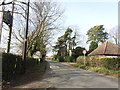
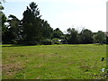

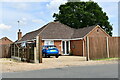
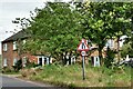

7 photos from this area
Area Information
Key information about the PE33 0HH including its size, population, and administrative classification.
- Area Type
- Postcode
- Area Size
- 4.9 hectares
- Population
- 2594
- Population Density
- 379 people/km²
House Prices in PE33 0HH
24
Properties
£158,612
Average Sold Price
£16,120
Lowest Price
£345,000
Highest Price
Showing 24 properties
| Address | Type | Beds | Baths | Last Sale Price | Last Sale Date | |
|---|---|---|---|---|---|---|
| 23 Mill Road, Watlington, PE33 0HH | Semi-detached | 2 | 1 | £225,000 | Dec 2024 | |
| 43 Mill Road, Watlington, PE33 0HH | house | - | - | £230,000 | Jan 2022 | |
| 61 Mill Road, Watlington, PE33 0HH | Detached | 4 | 2 | £345,000 | Mar 2019 | |
| 27 Mill Road, Watlington, PE33 0HH | Semi-detached | 3 | - | £160,000 | Apr 2017 | |
| 55 Mill Road, Watlington, PE33 0HH | Detached | 4 | 2 | £335,000 | Jan 2016 | |
| 41 Mill Road, Watlington, PE33 0HH | Semi-detached | - | - | £110,000 | Dec 2004 | |
| Brambles, 59 Mill Road, Watlington, PE33 0HH | Detached | - | - | £115,000 | Jun 2000 | |
| 53 Mill Road, Watlington, PE33 0HH | Detached | - | - | £25,000 | Apr 1997 | |
| 57 Mill Road, Watlington, PE33 0HH | Detached | - | - | £25,000 | Mar 1997 | |
| 29 Mill Road, Watlington, PE33 0HH | Semi-detached | - | - | £16,120 | Nov 1995 |
Page 1 of 3
Energy Efficiency in PE33 0HH
Amenities
Schools
| Rank | School | Type | Entry gender | Ages |
|---|
Explore more schools in this area
Go to Schools tabDemographics
Household Size
Two person
most common
Accommodation Type
Houses
most common
Tenure
76
majority
Ethnic Group
White
most common
Religion
N/A
most common
Household Composition
N/A
most common
Age
47
median
Adults (30-64 years)
most common
Household Deprivation
N/A
with no deprivation
NS-SEC
31
in Lower managerial occupations
Explore more demographic insights in this area
Go to Demographics tabPlanning
Planning Constraints
- Flood RiskPremium
- Ramsar Wetland SitesPremium
- Area of Outstanding Natural BeautyPremium
- Protected Nature ReservePremium
- Protected WoodlandPremium