Area Overview for PE33 0DR
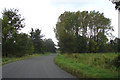
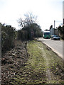
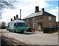
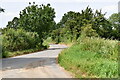
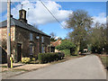
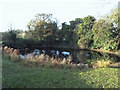
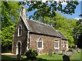
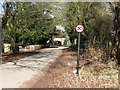
Photos of PE33 0DR


Area Information
PE33 0DR represents a specific postcode cluster in Norfolk, encompassing 28.8 hectares of land with a population of 1,384 people. This small residential area offers a distinct living environment defined by its manageable scale and low population density of 37 people per square kilometre. Residents here experience a quiet domestic setting typical of a small housing cluster in the English countryside. The area functions as a modest community where daily life revolves around local neighbourhood interactions rather than urban bustle. Living in PE33 0DR means accepting a quiet existence with limited amenities immediately on your doorstep. You will find yourself surrounded by a tight-knit group of neighbours who share a similar pace of life. The geography supports a peaceful routine, far removed from the congestion of larger towns. This postcode covers a compact zone that prioritises residential calm over commercial vibrancy. You are part of a community where the scale remains intimate and the surroundings feel expansive due to the low density of development.
- Area Type
- Postcode
- Area Size
- 28.8 hectares
- Population
- 1384
- Population Density
- 37 people/km²
The housing market in PE33 0DR is characterised by a predominance of houses, which form the main type of accommodation within the postcode. With 74% of the population reporting home ownership, this area operates largely as an owner-occupied market rather than a rental hub. Prospective buyers looking at homes in PE33 0DR will primarily encounter privately owned properties. This high level of ownership implies that the housing stock consists mostly of established family homes that have remained with successive generations or long-term owners. The small area size of 28.8 hectares limits the volume of available stock, suggesting a competitive market for those finding properties here. You are likely to encounter a range of property ages and styles typical of this specific residential cluster. The market dynamics favour those with stable histories rather than short-term tenants. When evaluating property options, you should expect to navigate a landscape dominated by freehold sales rather than rental agreements.
House Prices in PE33 0DR
Showing 12 properties
| Address | Type | Beds | Baths | Last Sale Price | Last Sale Date | |
|---|---|---|---|---|---|---|
| The Beagles, South Road, Shouldham Thorpe, PE33 0DR | Bungalow | 2 | 1 | £317,500 | Jan 2024 | |
| Gate House, South Road, Shouldham Thorpe, PE33 0DR | Detached | 4 | 1 | £825,000 | Nov 2022 | |
| The Cottage, South Road, Shouldham Thorpe, PE33 0DR | house | - | - | £277,000 | Jul 2021 | |
| Claypit Cottage, Shouldham Road, Shouldham Thorpe, PE33 0DR | house | - | - | £485,000 | May 2021 | |
| Loune, South Road, Shouldham Thorpe, PE33 0DR | Retail | 4 | 2 | £47,000 | Dec 1997 | |
| Gateside Barn, South Road, Shouldham Thorpe, PE33 0DR | Detached | - | - | - | - | |
| Willow Barn, Manor Farm, South Road, Shouldham Thorpe, PE33 0DR | Detached | 3 | - | - | - | |
| The Lodge, Manor Farm, South Road, Shouldham Thorpe, PE33 0DR | Detached | 3 | - | - | - | |
| Shepherds Cottage, South Road, Shouldham Thorpe, PE33 0DR | Detached | - | - | - | - | |
| Manor Farm Cottage, South Road, Shouldham Thorpe, PE33 0DR | house | - | - | - | - |
Energy Efficiency in PE33 0DR
Residents of PE33 0DR rely on a limited set of amenities within practical reach for their daily shopping and essential needs. Retail options include Lidl Bexwell, Morrisons Downham, and Iceland Downham, providing access to major supermarket chains. These stores allow residents to purchase groceries and household essentials without travelling to distant towns. Transport links connect you to Watlington Railway Station and Downham Market Railway Station, facilitating journeys to larger hubs. A notable nearby amenity is RAF Marham, which provides a landmark and indicates proximity to significant infrastructure. While the area lacks a high density of leisure venues or diverse dining, the available supermarkets ensure self-sufficiency. Your daily life in PE33 0DR involves scheduled trips to these specific retail locations rather than spontaneous visits to multiple shops. The railway stations offer a viable alternative to car travel for commuting. Living here requires a car for most non-essential errands, as the nearest amenities cluster around the named commercial centres.
Amenities
Schools
Families living in PE33 0DR have access to a range of educational institutions within practical commuting distance. Three Church of England primary schools serve the local area: Wormegay Church of England Primary School, Runcton Holme Church of England Primary School, and Holy Cross Church of England Primary School. Holy Cross holds a good Ofsted rating, offering parents a verified standard of education for younger children. For families seeking an alternative to state education, The Old Mill House School operates as an independent school nearby. These options provide a mix of maintained and private educational pathways for residents. The presence of multiple primary schools indicates a functional network for young families, while the independent option caters to those preferring a different academic environment. When considering schools near PE33 0DR, you have a selection that includes both traditional church-affiliated primary institutions and a private alternative. This variety ensures that most families can find a suitable institution for their children.
| Rank | School | Type | Entry gender | Ages |
|---|
Explore more schools in this area
Go to Schools tabDemographics
The community within PE33 0DR is defined by a mature demographic profile. The median age stands at 47 years, indicating that adults between the ages of 30 and 64 years are the largest age group in the area. This age distribution suggests a neighbourhood populated by established households rather than young families or students. Home ownership is a dominant feature of this community, with 74% of residents owning their property outright or with a mortgage. Such a high ownership rate points to long-term residents who have settled in the area. The predominant ethnic group in PE33 0DR is White, reflecting the typical demographic composition of rural Norfolk villages and hamlets. Houses are the primary form of accommodation, aligning with the established character of the housing stock. This statistical profile paints a picture of a stable, owner-occupied neighbourhood where families and retirees likely form the backbone of the community structure.
Household Size
Accommodation Type
Tenure
Ethnic Group
Religion
Household Composition
Age
Household Deprivation
NS-SEC
Explore more demographic insights in this area
Go to Demographics tabPlanning
Planning Constraints
- Flood RiskPremium
- Ramsar Wetland SitesPremium
- Area of Outstanding Natural BeautyPremium
- Protected Nature ReservePremium
- Protected WoodlandPremium