Area Overview for PE32 2ST
Photos of PE32 2ST

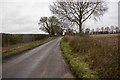
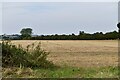
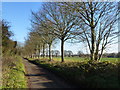
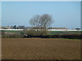
10 photos from this area
Area Information
Key information about the PE32 2ST including its size, population, and administrative classification.
- Area Type
- Postcode
- Area Size
- 32.6 hectares
- Population
- 2143
- Population Density
- 37 people/km²
House Prices in PE32 2ST
19
Properties
£233,750
Average Sold Price
£80,000
Lowest Price
£410,000
Highest Price
Showing 19 properties
| Address | Type | Beds | Baths | Last Sale Price | Last Sale Date | |
|---|---|---|---|---|---|---|
| Meadow View, Massingham Road, Weasenham All Saints, PE32 2ST | Detached | 3 | 1 | £352,500 | Nov 2025 | |
| 37, The Cottages, Massingham Road, Weasenham All Saints, PE32 2ST | house | - | - | £120,000 | Jun 2021 | |
| 33, The Cottages, Massingham Road, Weasenham All Saints, PE32 2ST | house | - | - | £130,000 | Jun 2020 | |
| 34, The Cottages, Massingham Road, Weasenham All Saints, PE32 2ST | house | 2 | - | £80,000 | Jun 2020 | |
| 35, The Cottages, Massingham Road, Weasenham All Saints, PE32 2ST | house | - | - | £80,000 | Jun 2020 | |
| Ballacraine, Massingham Road, Weasenham All Saints, PE32 2ST | Detached | 5 | - | £350,000 | Mar 2020 | |
| Jannic, Massingham Road, Weasenham All Saints, PE32 2ST | Detached | 4 | 2 | £320,000 | Dec 2019 | |
| 43, The Cottages, Massingham Road, Weasenham All Saints, PE32 2ST | house | 2 | 1 | £220,000 | Feb 2019 | |
| 39, The Cottages, Massingham Road, Weasenham All Saints, PE32 2ST | Terraced | - | - | £275,000 | Feb 2007 | |
| Orchard House, Massingham Road, Weasenham All Saints, PE32 2ST | Detached | 4 | 2 | £410,000 | May 2004 |
Page 1 of 2
Energy Efficiency in PE32 2ST
Amenities
Schools
| Rank | School | Type | Entry gender | Ages |
|---|
Explore more schools in this area
Go to Schools tabDemographics
Household Size
Two person
most common
Accommodation Type
Houses
most common
Tenure
72
majority
Ethnic Group
White
most common
Religion
N/A
most common
Household Composition
N/A
most common
Age
47
median
Adults (30-64 years)
most common
Household Deprivation
N/A
with no deprivation
NS-SEC
33
in Lower managerial occupations
Explore more demographic insights in this area
Go to Demographics tabPlanning
Planning Constraints
- Flood RiskPremium
- Ramsar Wetland SitesPremium
- Area of Outstanding Natural BeautyPremium
- Protected Nature ReservePremium
- Protected WoodlandPremium