Area Overview for PE32 2QS
Photos of PE32 2QS
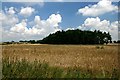
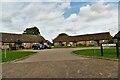
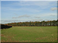
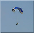
4 photos from this area
Area Information
Key information about the PE32 2QS including its size, population, and administrative classification.
- Area Type
- Postcode
- Area Size
- 11.3 hectares
- Population
- 2160
- Population Density
- 37 people/km²
House Prices in PE32 2QS
22
Properties
£182,167
Average Sold Price
£112,500
Lowest Price
£265,000
Highest Price
Showing 22 properties
| Address | Type | Beds | Baths | Last Sale Price | Last Sale Date | |
|---|---|---|---|---|---|---|
| 19 Wellingham Road, Litcham, PE32 2QS | Semi-detached | 4 | 2 | £265,000 | Apr 2023 | |
| 18 Wellingham Road, Litcham, PE32 2QS | Retail | 3 | 1 | £245,000 | Sep 2022 | |
| 28 Wellingham Road, Litcham, PE32 2QS | house | - | - | £212,500 | Sep 2021 | |
| 26 Wellingham Road, Litcham, PE32 2QS | Semi-detached | 3 | 1 | £220,000 | Jan 2019 | |
| Winter Rules, Wellingham Road, Litcham, PE32 2QS | Detached | 4 | 1 | £255,000 | Oct 2018 | |
| 22 Wellingham Road, Litcham, PE32 2QS | Semi-detached | 3 | 1 | £190,000 | May 2018 | |
| 33 Wellingham Road, Litcham, PE32 2QS | Semi-detached | 3 | - | £127,500 | Jun 2014 | |
| 27 Wellingham Road, Litcham, PE32 2QS | house | 3 | 1 | £140,000 | Dec 2013 | |
| 19A Wellingham Road, Litcham, PE32 2QS | house | 3 | - | £144,000 | Oct 2011 | |
| 31 Wellingham Road, Litcham, PE32 2QS | Detached | 3 | 1 | £130,000 | Dec 2009 |
Page 1 of 3
Energy Efficiency in PE32 2QS
Amenities
Schools
| Rank | School | Type | Entry gender | Ages |
|---|
Explore more schools in this area
Go to Schools tabDemographics
Household Size
Two person
most common
Accommodation Type
Houses
most common
Tenure
66
majority
Ethnic Group
White
most common
Religion
N/A
most common
Household Composition
N/A
most common
Age
47
median
Adults (30-64 years)
most common
Household Deprivation
N/A
with no deprivation
NS-SEC
31
in Lower managerial occupations
Explore more demographic insights in this area
Go to Demographics tabPlanning
Planning Constraints
- Flood RiskPremium
- Ramsar Wetland SitesPremium
- Area of Outstanding Natural BeautyPremium
- Protected Nature ReservePremium
- Protected WoodlandPremium