Area Overview for PE32 2PH
Photos of PE32 2PH
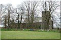

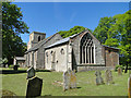
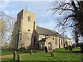
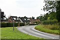

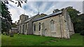
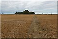

29 photos from this area
Area Information
Key information about the PE32 2PH including its size, population, and administrative classification.
- Area Type
- Postcode
- Area Size
- 4.3 hectares
- Population
- 2143
- Population Density
- 37 people/km²
House Prices in PE32 2PH
24
Properties
£237,461
Average Sold Price
£25,000
Lowest Price
£445,000
Highest Price
Showing 24 properties
| Address | Type | Beds | Baths | Last Sale Price | Last Sale Date | |
|---|---|---|---|---|---|---|
| Peasants Rest, Fakenham Road, Tittleshall, PE32 2PH | Bungalow | 3 | 1 | £420,000 | Mar 2023 | |
| Silver Birch, 3 Fakenham Road, Tittleshall, PE32 2PH | Detached | 3 | 2 | £445,000 | Dec 2022 | |
| Bethal, Fakenham Road, Tittleshall, PE32 2PH | Terraced | 2 | 1 | £184,000 | Nov 2022 | |
| 32 Fakenham Road, Tittleshall, PE32 2PH | Detached | 3 | 1 | £247,000 | Nov 2021 | |
| 36 Fakenham Road, Tittleshall, PE32 2PH | house | 3 | - | £252,000 | Dec 2020 | |
| Maple Lodge, Fakenham Road, Tittleshall, PE32 2PH | Detached | 3 | - | £435,000 | May 2020 | |
| Pegasus, Fakenham Road, Tittleshall, PE32 2PH | Cottage | 2 | 1 | £210,000 | Jun 2019 | |
| Kilsaren, Fakenham Road, Tittleshall, PE32 2PH | Bungalow | 4 | 3 | £415,000 | Dec 2016 | |
| White Lodge, 72 Fakenham Road, Tittleshall, PE32 2PH | Detached | 4 | - | £255,000 | Sep 2015 | |
| 68 Fakenham Road, Tittleshall, PE32 2PH | house | - | - | £220,000 | Jun 2015 |
Page 1 of 3
Energy Efficiency in PE32 2PH
Amenities
Schools
| Rank | School | Type | Entry gender | Ages |
|---|
Explore more schools in this area
Go to Schools tabDemographics
Household Size
Two person
most common
Accommodation Type
Houses
most common
Tenure
72
majority
Ethnic Group
White
most common
Religion
N/A
most common
Household Composition
N/A
most common
Age
47
median
Adults (30-64 years)
most common
Household Deprivation
N/A
with no deprivation
NS-SEC
33
in Lower managerial occupations
Explore more demographic insights in this area
Go to Demographics tabPlanning
Planning Constraints
- Flood RiskPremium
- Ramsar Wetland SitesPremium
- Area of Outstanding Natural BeautyPremium
- Protected Nature ReservePremium
- Protected WoodlandPremium