Area Overview for PE32 2NL
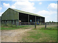
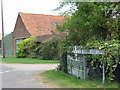
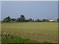
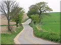
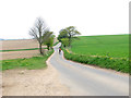
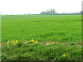
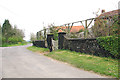
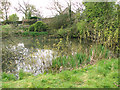
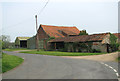
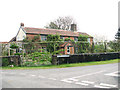
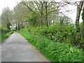
Photos of PE32 2NL
Area Information
Living in PE32 2NL offers a quiet existence within a defined residential cluster. This specific postcode covers just 63.1 hectares of land, creating a compact community where neighbours are often within natural walking distance. With a population of 2,160 individuals, the area maintains a low population density of 37 people per square kilometre. This scarcity of residents per unit of space suggests a predominantly rural or semi-rural setting rather than a dense urban environment. The layout supports a slower pace of life compared to larger towns, yet the location remains accessible to essential services. Residents here enjoy a setting that prioritises open space and lower noise levels. The small面积 ensures that the community feels intimate and manageable. You will find that daily life revolves around the immediate surroundings rather than heavy reliance on travel to distant centres. The area represents a pragmatic choice for those seeking homes in a settlement that avoids the congestion of larger population hubs. It is a place where the scale of development matches the settlement's historical footprint, providing a stable environment for long-term residency without the pressure of rapid expansion.
- Area Type
- Postcode
- Area Size
- 63.1 hectares
- Population
- 2160
- Population Density
- 37 people/km²
The property market in PE32 2NL is characterised largely by owner-occupied homes. A stunning majority of the housing stock consists of houses, with 66% of residents classified as homeowners. This statistic indicates that the area is not primarily a rental hotspot but rather a place where people buy to stay. The accommodation type is strictly houses, meaning you will not find flats or purpose-built apartments within this specific postcode sector. This homogeneity appeals to buyers seeking traditional British residential homes rather than modern apartment living. The high ownership rate implies that the market movements here will largely depend on owners deciding to move or sell. For a prospective buyer entering this market, competition may centre on finding well-maintained houses among a limited number of available properties. The lack of rental apartments suggests a steady demand for ownership rather than investment speculation. When considering homes in this area, you should expect a range of house styles typical of established English settlements. The market functions on the principle of legacy ownership, making transactions potentially more stable but perhaps less fluid than in purely rental-driven zones.
House Prices in PE32 2NL
Showing 14 properties
| Address | Type | Beds | Baths | Last Sale Price | Last Sale Date | |
|---|---|---|---|---|---|---|
| Jester House, Water End Lane, Beeston, PE32 2NL | house | - | - | £599,995 | Apr 2023 | |
| Apple Tree Cottage, Water End Lane, Beeston, PE32 2NL | house | - | - | £350,000 | Oct 2022 | |
| Rose Acre, Water End Lane, Beeston, PE32 2NL | Detached | 4 | - | £675,000 | Jul 2022 | |
| 3, Holmedene Cottages, Water End Lane, Beeston, PE32 2NL | house | - | - | £225,000 | Jan 2021 | |
| 1, Holmedene Cottages, Water End Lane, Beeston, PE32 2NL | Cottage | 2 | 1 | £210,000 | Feb 2018 | |
| Water Farm, Water End Lane, Beeston, PE32 2NL | house | - | - | £810,000 | Dec 2017 | |
| The Croft, Water End Lane, Beeston, PE32 2NL | Detached | - | - | £75,000 | Sep 1996 | |
| Windy Ridges, Water End Lane, Beeston, PE32 2NL | Bungalow | - | - | - | - | |
| Grannys Pightle, Water End Lane, Beeston, PE32 2NL | house | - | - | - | - | |
| Primrose Farm House, Water End Lane, Beeston, PE32 2NL | Detached | - | - | - | - |
Energy Efficiency in PE32 2NL
Daily life in PE32 2NL centres on a convenience model that relies on larger nearby towns for major shopping. Your nearest retail amenities are located in Necton, specifically Asda Necton, East of England Co-operative Co, and Co-op East. These five notable retailers provide a baseline for grocery shopping and everyday essentials without needing to travel far into town centres. For railway travel, Dereham station serves as the primary metro link for the area. This one notable train station gives you access to broader regional transport networks. Reaching significant shopping or leisure destinations involves a short journey from this postcode sector. The layout encourages self-drive trips to Necton for bulk shopping supplies. While local amenities are few, they are defined by practical utility rather than expansive variety. The presence of a Co-operative and Asda ensures that basic household needs can be met without excessive fuss. Town centre leisure activities will require outward travel, as the local data highlights no designated parks or leisure centres within the immediate sector. The lifestyle is therefore practical and transport-dependent for anything beyond basic groceries and daily maintenance.
Amenities
Schools
Families living in PE32 2NL have access to a range of primary educational institutions within practical reach. The nearest options include Beeston Primary School, Great Dunham Primary School, Litcham Primary School, and Litcham School. Today's data lists both Beeston Primary School and Great Dunham Primary School as primary options for local education. Parents have multiple choices for founding years education, with four distinct institutions named in the immediate vicinity. The presence of Litcham Primary School and Litcham School provides another layer of educational infrastructure for young children. The mix of schools named suggests a typical rural catchment area where multiple providers serve a low-density population. Since the data only lists primary-level institutions, families with older children may need to look towards nearby towns for secondary education options. The variety of names indicates a distributed network rather than a single hub serving the whole region. Any parent considering moving here should cross-reference these locations with their child's age to determine the correct catchment alignment. The availability of these specific schools makes the area viable for families with children of primary school age.
| Rank | School | Type | Entry gender | Ages |
|---|
Explore more schools in this area
Go to Schools tabDemographics
The community in PE32 2NL is defined by a mature demographic profile. The median age stands at 47 years, indicating that the resident population skews significantly older than the national average. Most residents fall into the adult age range of 30 to 64 years, suggesting a workforce and family demographic rather than a retirement-only village. This concentration of middle-aged adults often correlates with established households and settled family units. Home ownership is a defining characteristic of the area, with 66% of residents owning their properties outright or with a mortgage. This high level of ownership suggests stability and long-term commitment to the locality. The accommodation type is exclusively houses, which aligns with the older demographic and the desire for detached or semi-detached living spaces. The predominant ethnic group identified is White, reflecting the area's composition as a traditional English settlement. These factors combine to create a neighbourhood where professional families and empty nesters likely make up the bulk of the population. The data points to a community focused on domestic stability rather than transient student housing or high-turnover rental markets.
Household Size
Accommodation Type
Tenure
Ethnic Group
Religion
Household Composition
Age
Household Deprivation
NS-SEC
Explore more demographic insights in this area
Go to Demographics tabPlanning
Planning Constraints
- Flood RiskPremium
- Ramsar Wetland SitesPremium
- Area of Outstanding Natural BeautyPremium
- Protected Nature ReservePremium
- Protected WoodlandPremium