Area Overview for PE32 2JL
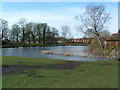
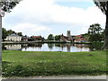
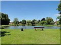
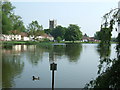
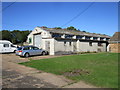
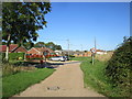
Photos of PE32 2JL


Area Information
PE32 2JL is a small residential cluster covering 24.9 hectares within the PE32 postcode district in Norfolk. With a population of 2,294 residents, the area maintains a low density of 23 people per square kilometre. This sparse distribution defines daily life here, offering a quiet country setting far from the noise of major urban centres. The postcode represents a specific selection of homes rather than a bustling town centre or high-density estate. Living in PE32 2JL means embracing a secluded lifestyle where the immediate neighbourhood feels vast compared to the number of inhabitants. The physical footprint is compact enough to allow for easy movement on foot, yet the low population density ensures that the area retains a rural character. Prospective buyers often choose this location for the space and tranquility available in a small geographic pocket. The area serves as a quiet hub for those who prioritise space over proximity to city amenities. Every home in this cluster offers a degree of privacy that aligns with the smaller population figure.
- Area Type
- Postcode
- Area Size
- 24.9 hectares
- Population
- 2294
- Population Density
- 23 people/km²
The housing stock in PE32 2JL is composed primarily of houses, which aligns with the area's rural nature and low density of 23 people per square kilometre. Home ownership accounts for 54% of households, creating a market where buying a weekend retreat or a permanent family home is a common route for local buyers. The prevalence of non-ownership implies a viable rental market exists alongside sale-on-market properties, though rental scarcity may be possible given the limited total housing supply in a 24.9-hectare area. Prospective buyers seeking houses in PE32 2JL will encounter a market defined by traditional building styles suited to the Norfolk countryside. The small population of 2,294 residents limits the turnover rate, meaning competition for purchases may be moderate rather than frenetic. For those interested in the property market of this specific postcode, the focus remains on detached or semi-detached dwellings rather than urban blocks. The mix of owner-occupiers and landlords creates stability, ensuring that properties remain in hands that value long-term maintenance. You can expect a clean, predictable market where the total number of listings directly reflects the small resident base.
House Prices in PE32 2JL
Showing 2 properties
| Address | Type | Beds | Baths | Last Sale Price | Last Sale Date | |
|---|---|---|---|---|---|---|
| The Lodge, Station Road, Little Massingham, PE32 2JL | house | - | - | - | - | |
| Little Massingham House, Station Road, Little Massingham, PE32 2JL | Detached | - | - | - | - |
Energy Efficiency in PE32 2JL
Daily life for residents of PE32 2JL revolves around local amenities that are practical rather than extensive. The nearest significant retail outlet is Budgens Castle, located within the broader PE32 neighbourhood sphere. This single notable store provides essential grocery shopping and convenience needs for the 2,294 people living in this postcode. With a small population density of 23 people per square kilometre, you will not find a high street of shops or pubs directly within the housing cluster. Visits to Budgens Castle form the backbone of weekly errands, meaning a car is essential for accessing other services outside the immediate cluster. The lack of additional listed amenities highlights a truly rural existence where specialised goods require travel to larger towns like Thetford or Diss. Residents rely on the one major supermarket for food and household items, while leisure activities likely depend on the natural surroundings. This limited retail footprint ensures the area remains quiet and free from tourist crowds, perfect for those who prefer a self-contained, low-key routine.
Amenities
Schools
Family life in PE32 2JL is largely supported by a network of Church of England primary schools within easy reach. Nearby options include Great Massingham CofE Primary School, which holds a Good Ofsted rating. Other primary choices are Flitcham Voluntary Aided Church of England Primary School, Sandringham and West Newton Church of England Primary School, Flitcham Church of England Primary Academy, and Sandringham and West Newton Church of England Primary Academy. The latter two also carry a Good Ofsted rating along with their Voluntary Aided or Catholic Church affiliations. Renaming or structural changes appear to affect some of these institutions, but the immediate vicinity offers multiple state-funded primary education options. There are no secondary schools listed in the direct vicinity of the PE32 postcode, meaning older children likely attend institutions in larger nearby towns. The concentration of primary schools suggests this area is popular with families with young children looking for a rural community context. Access to these specific schools ensures that residents have local educational pathways without needing long commutes for early education.
| Rank | School | Type | Entry gender | Ages |
|---|
Explore more schools in this area
Go to Schools tabDemographics
Adults aged 30 to 64 years form the most common age group within the community, reflecting a median age of 47 years. This demographic profile suggests an area populated by established residents rather than families on the move or young students. Home ownership stands at 54%, indicating that slightly more than half of the households in PE32 2JL own their property outright or with a mortgage. The remaining majority likely rents or shares accommodation, which is consistent with a smaller settlement where rental stock may exist alongside owner-occupied stock. Houses are the predominant accommodation type, meaning you will find semi-detached, detached, and terraced family homes rather than city flats or purpose-built apartments. The population is predominantly White, mirroring the broader historical settlement patterns of rural Norfolk. The age structure implies a relative lack of young children, while the high proportion of adults suggests many residents are settled into long-term careers or retirement. This demographic makeup influences local demand for services, community events, and the general pace of life in the postcode.
Household Size
Accommodation Type
Tenure
Ethnic Group
Religion
Household Composition
Age
Household Deprivation
NS-SEC
Explore more demographic insights in this area
Go to Demographics tabPlanning
Planning Constraints
- Flood RiskPremium
- Ramsar Wetland SitesPremium
- Area of Outstanding Natural BeautyPremium
- Protected Nature ReservePremium
- Protected WoodlandPremium