Area Overview for PE32 2DS
Photos of PE32 2DS

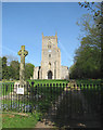
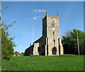

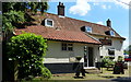
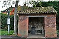
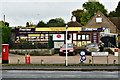
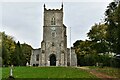
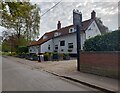

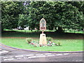

19 photos from this area
Area Information
Key information about the PE32 2DS including its size, population, and administrative classification.
- Area Type
- Postcode
- Area Size
- 53.2 hectares
- Population
- 2520
- Population Density
- 45 people/km²
House Prices in PE32 2DS
36
Properties
£290,323
Average Sold Price
£43,500
Lowest Price
£895,000
Highest Price
Showing 36 properties
| Address | Type | Beds | Baths | Last Sale Price | Last Sale Date | |
|---|---|---|---|---|---|---|
| Glebe House, 45 The Street, Sporle, PE32 2DS | Detached | 5 | 2 | £420,000 | May 2025 | |
| The Byre, 63 The Street, Sporle, PE32 2DS | Retail | 2 | 1 | £350,000 | Apr 2023 | |
| Thatched Cottage, 27 The Street, Sporle, PE32 2DS | Cottage | 3 | 2 | £310,000 | Nov 2021 | |
| Priory Cottage, 43 The Street, Sporle, PE32 2DS | Detached | 5 | 1 | £425,000 | Jun 2021 | |
| Priory Farm House, 51 The Street, Sporle, PE32 2DS | Semi-detached | 4 | 1 | £370,000 | Jun 2021 | |
| Stream Cottage, 41 The Street, Sporle, PE32 2DS | house | 4 | - | £339,950 | Mar 2021 | |
| 57 The Street, Sporle, PE32 2DS | house | - | - | £315,000 | Sep 2020 | |
| Orchard House, 29A The Street, Sporle, PE32 2DS | Detached | 4 | 3 | £395,000 | Nov 2019 | |
| Railway Farm, 81 The Street, Sporle, PE32 2DS | Detached | 4 | - | £250,000 | Aug 2019 | |
| Turnstone House, 23 The Street, Sporle, PE32 2DS | Detached | 3 | 1 | £245,000 | Feb 2016 |
Page 1 of 4
Energy Efficiency in PE32 2DS
Amenities
Schools
| Rank | School | Type | Entry gender | Ages |
|---|
Explore more schools in this area
Go to Schools tabDemographics
Household Size
Two person
most common
Accommodation Type
Houses
most common
Tenure
71
majority
Ethnic Group
White
most common
Religion
N/A
most common
Household Composition
N/A
most common
Age
47
median
Adults (30-64 years)
most common
Household Deprivation
N/A
with no deprivation
NS-SEC
28
in Lower managerial occupations
Explore more demographic insights in this area
Go to Demographics tabPlanning
Planning Constraints
- Flood RiskPremium
- Ramsar Wetland SitesPremium
- Area of Outstanding Natural BeautyPremium
- Protected Nature ReservePremium
- Protected WoodlandPremium