Area Overview for PE32 2BT
Photos of PE32 2BT
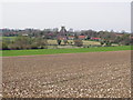
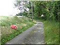
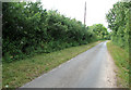
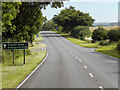
15 photos from this area
Area Information
Key information about the PE32 2BT including its size, population, and administrative classification.
- Area Type
- Postcode
- Area Size
- 35.3 hectares
- Population
- 2520
- Population Density
- 45 people/km²
House Prices in PE32 2BT
11
Properties
£353,900
Average Sold Price
£210,000
Lowest Price
£650,000
Highest Price
Showing 11 properties
| Address | Type | Beds | Baths | Last Sale Price | Last Sale Date | |
|---|---|---|---|---|---|---|
| Garden Cottage, Newton Road, Castle Acre, PE32 2BT | house | - | - | £462,500 | Jun 2020 | |
| 1, Brookside, Newton Road, Castle Acre, PE32 2BT | Bungalow | 3 | - | £217,000 | May 2014 | |
| Fiddlers Green, Newton Road, Castle Acre, PE32 2BT | Detached | - | - | £650,000 | Jan 2011 | |
| 2, Brookside, Newton Road, Castle Acre, PE32 2BT | Bungalow | - | - | £230,000 | Oct 2009 | |
| Broadmeadow House, Newton Road, Castle Acre, PE32 2BT | Detached | - | - | £210,000 | Aug 2001 | |
| Arden Hurst, Newton Road, Castle Acre, PE32 2BT | Bungalow | 4 | 2 | - | - | |
| Brookside Barn, Newton Road, Castle Acre, PE32 2BT | house | - | - | - | - | |
| 4 Newton Road, Newton By Castle Acre, PE32 2BT | house | - | - | - | - | |
| 2 Newton Road, Newton By Castle Acre, PE32 2BT | Semi-detached | - | - | - | - | |
| 3 Newton Road, Newton By Castle Acre, PE32 2BT | Semi-detached | - | - | - | - |
Page 1 of 2
Energy Efficiency in PE32 2BT
Amenities
Schools
| Rank | School | Type | Entry gender | Ages |
|---|
Explore more schools in this area
Go to Schools tabDemographics
Household Size
Two person
most common
Accommodation Type
Houses
most common
Tenure
71
majority
Ethnic Group
White
most common
Religion
N/A
most common
Household Composition
N/A
most common
Age
47
median
Adults (30-64 years)
most common
Household Deprivation
N/A
with no deprivation
NS-SEC
28
in Lower managerial occupations
Explore more demographic insights in this area
Go to Demographics tabPlanning
Planning Constraints
- Flood RiskPremium
- Ramsar Wetland SitesPremium
- Area of Outstanding Natural BeautyPremium
- Protected Nature ReservePremium
- Protected WoodlandPremium