Area Overview for PE32 2BQ
Photos of PE32 2BQ
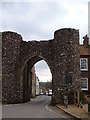
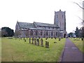
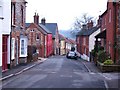
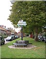
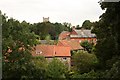
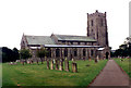
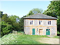
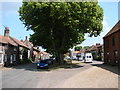
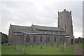

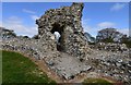
100 photos from this area
Area Information
Key information about the PE32 2BQ including its size, population, and administrative classification.
- Area Type
- Postcode
- Area Size
- 4237 m²
- Population
- 2635
- Population Density
- 38 people/km²
House Prices in PE32 2BQ
16
Properties
£165,750
Average Sold Price
£49,500
Lowest Price
£450,000
Highest Price
Showing 16 properties
| Address | Type | Beds | Baths | Last Sale Price | Last Sale Date | |
|---|---|---|---|---|---|---|
| 26 High Street, Castle Acre, PE32 2BQ | Terraced | 3 | 1 | £195,000 | Aug 2016 | |
| 18 High Street, Castle Acre, PE32 2BQ | Terraced | 2 | 1 | £140,000 | Jan 2016 | |
| 17 High Street, Castle Acre, PE32 2BQ | Terraced | 2 | 1 | £157,000 | Oct 2014 | |
| 19 High Street, Castle Acre, PE32 2BQ | Semi-detached | 3 | - | £450,000 | Oct 2014 | |
| 20 High Street, Castle Acre, PE32 2BQ | Terraced | 2 | - | £154,000 | Dec 2013 | |
| 22 High Street, Castle Acre, PE32 2BQ | house | 2 | - | £49,500 | Sep 1999 | |
| 25 High Street, Castle Acre, PE32 2BQ | house | 2 | - | £51,000 | Jul 1999 | |
| 14 High Street, Castle Acre, PE32 2BQ | Semi-detached | - | - | £129,500 | Nov 1996 | |
| 23 High Street, Castle Acre, PE32 2BQ | Cottage | 3 | 1 | - | - | |
| 48 High Street, Castle Acre, PE32 2BQ | Cottage | 2 | 1 | - | - |
Page 1 of 2
Energy Efficiency in PE32 2BQ
Amenities
Schools
| Rank | School | Type | Entry gender | Ages |
|---|
Explore more schools in this area
Go to Schools tabDemographics
Household Size
Two person
most common
Accommodation Type
Houses
most common
Tenure
63
majority
Ethnic Group
White
most common
Religion
N/A
most common
Household Composition
N/A
most common
Age
47
median
Adults (30-64 years)
most common
Household Deprivation
N/A
with no deprivation
NS-SEC
29
in Lower managerial occupations
Explore more demographic insights in this area
Go to Demographics tabPlanning
Planning Constraints
- Flood RiskPremium
- Ramsar Wetland SitesPremium
- Area of Outstanding Natural BeautyPremium
- Protected Nature ReservePremium
- Protected WoodlandPremium