Area Overview for PE32 1SB
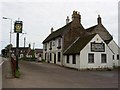
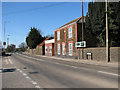
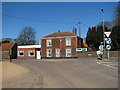
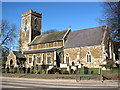
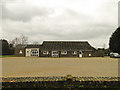
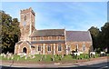
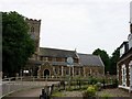
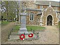
Photos of PE32 1SB
Area Information
Living in PE32 1SB means residing within a compact residential cluster that covers exactly 6.0 hectares. This specific postcode area holds a population of 1,469 people, resulting in a density of 113 residents per square kilometre. The environment is characterised by close proximity to housing rather than sprawl, creating a setting where neighbours are likely within easy sight. You will find that daily life is defined by practicality over grandeur, with most of your immediate surroundings dedicated to living space. The area functions as a focused community hub rather than a sprawling district, offering a distinct sense of place for those who admire smaller-scale neighbourhoods. Because the land usage is tightly packed, you may experience less separation from your immediate community compared to larger postcodes. This concentration supports a slower pace of life, typical of localities that prioritise established housing stock over extensive development. When considering homes in PE32 1SB, you are choosing a location where the built environment dominates the landscape, offering stability and familiarity. The small footprint ensures that local services and routes remain direct, removing the need for lengthy commutes within the immediate area.
- Area Type
- Postcode
- Area Size
- 6.0 hectares
- Population
- 1469
- Population Density
- 113 people/km²
The property market in PE32 1SB is overwhelmingly owner-occupied, with evidence showing that 80% of homes are owned by their residents. This statistic marks the area as a purchased market rather than a rental hub, distinguishing it from zones with high student or immigrant worker populations. The predominant accommodation type listed is houses, meaning you will encounter traditional detached or semi-detached properties rather than conversions or blocks of flats. This housing stock aligns perfectly with the local demographic of owners aged 30 to 64. When looking at homes in PE32 1SB, you are entering a sector where the majority of transactions involve families moving between owner-occupied stock. The market moves differently here compared to high-density urban centres where rental demand drives prices. Instead, values are likely influenced by the quality of the houses and their condition. Since the area is primarily self-owned, the turnover rate may be slower than in more transient districts. This stability benefits buyers seeking a permanent base, though it can mean fewer new listings appear frequently. The high ownership rate underscores a community invested in maintaining its property values.
House Prices in PE32 1SB
Showing 18 properties
| Address | Type | Beds | Baths | Last Sale Price | Last Sale Date | |
|---|---|---|---|---|---|---|
| 14, Freebridge Terrace, School Road, Middleton, PE32 1SB | Semi-detached | 3 | 1 | £168,500 | Sep 2020 | |
| 5, Freebridge Terrace, School Road, Middleton, PE32 1SB | house | - | - | £140,000 | Jan 2017 | |
| 6, Freebridge Terrace, School Road, Middleton, PE32 1SB | Semi-detached | 4 | 1 | £210,000 | Jul 2016 | |
| 11, Freebridge Terrace, School Road, Middleton, PE32 1SB | Semi-detached | 3 | 1 | £172,500 | Aug 2007 | |
| 2, Freebridge Terrace, School Road, Middleton, PE32 1SB | Terraced | 2 | 1 | - | - | |
| 1, Freebridge Terrace, School Road, Middleton, PE32 1SB | Land | - | - | - | - | |
| 9, Freebridge Terrace, School Road, Middleton, PE32 1SB | Semi-detached | - | - | - | - | |
| 10, Freebridge Terrace, School Road, Middleton, PE32 1SB | Semi-detached | - | - | - | - | |
| 3, Freebridge Terrace, School Road, Middleton, PE32 1SB | house | - | - | - | - | |
| 15, Freebridge Terrace, School Road, Middleton, PE32 1SB | Semi-detached | - | - | - | - |
Energy Efficiency in PE32 1SB
Residents of PE32 1SB enjoy access to a variety of amenities within practical reach, including major supermarkets and transport hubs. Retail choices are anchored by Sainsburys Kings, Iceland Kings, and Tesco Kings, providing essential shopping without needing to travel far. If you have a car, Kings Lynn Railway Station and Watlington Railway Station offer two rail connections nearby for wider travel. Ferry access is available via the King's Lynn Ferry Landing and West Lynn Ferry Landing, potentially useful for coastal or inter-island travel. An aviation element is present too, with RAF Marham located within the practical reach of the area. These amenities form the practical backbone of daily life, offering food, travel options, and leisure opportunities close to home. The concentration of shops like Sainsburys and Iceland in the Kings locality means you can complete most weekly errands efficiently. Transport links at Kings Lynn and Watlington ensure you are not isolated for longer trips. You do not need to venture far for essentials, which suits the lifestyle of those who prefer shorter commutes to daily outlets.
Amenities
Schools
Families in PE32 1SB are served by two primary institutions located nearby: Middleton Voluntary Controlled Primary School and Middleton Church of England Primary Academy. Both schools fall into the primary education category, catering to children from birth up to age eleven. It is important to note the performance ratings as you evaluate your options, because one school shows an Ofsted rating of inadequate. This creates a clear division in the local educational landscape, as not every nearby institution meets high standards. Schools near PE32 1SB do not include secondary options in the immediate vicinity data provided, suggesting families may rely on these primary schools before transitioning elsewhere. The presence of a Church of England academy indicates an educational choice rooted in specific religious traditions, while the Voluntary Controlled status offers a maintained alternative. You must weigh the impact of the inadequate rating carefully when planning a child's education path. For those with children entering the system, the choice is limited to these two specific options. The lack of secondary school data means you must look beyond this immediate postcode for high school requirements.
| Rank | School | Type | Entry gender | Ages |
|---|
Explore more schools in this area
Go to Schools tabDemographics
The community profile of PE32 1SB reflects a mature population, with a median age of 47 years. Most residents fall into the 30 to 64-year-old range, indicating a domestic scene dominated by adults rather than teenagers or pensioners. This age distribution supports a neighbourhood where life experiences are shared among householders who have likely established deep roots. Home ownership is a defining feature, with 80% of residents owning their property outright. This high percentage suggests a stable community where families have long-term ties to the location rather than transient tenancies. The predominant accommodation type within the area consists of houses, contrasting with flats found in more urban environments. Since the population is primarily White, the area maintains a homogenous demographic character typical of many established rural or semi-rural clusters. The combination of high ownership rates and an adult population creates a settled atmosphere. You can expect a community where decisions are often driven by long-term residents who understand the local rhythm. The lack of significant youth or elderly populations means the local focus centres on working-age families and professionals.
Household Size
Accommodation Type
Tenure
Ethnic Group
Religion
Household Composition
Age
Household Deprivation
NS-SEC
Explore more demographic insights in this area
Go to Demographics tabPlanning
Planning Constraints
- Flood RiskPremium
- Ramsar Wetland SitesPremium
- Area of Outstanding Natural BeautyPremium
- Protected Nature ReservePremium
- Protected WoodlandPremium