Area Overview for PE32 1LR
Photos of PE32 1LR
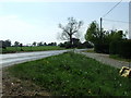
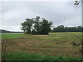
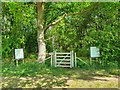
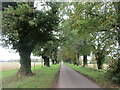
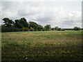
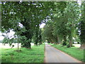
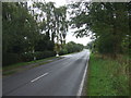
7 photos from this area
Area Information
Key information about the PE32 1LR including its size, population, and administrative classification.
- Area Type
- Postcode
- Area Size
- 35.5 hectares
- Population
- 2462
- Population Density
- 60 people/km²
House Prices in PE32 1LR
20
Properties
£377,818
Average Sold Price
£198,000
Lowest Price
£885,000
Highest Price
Showing 20 properties
| Address | Type | Beds | Baths | Last Sale Price | Last Sale Date | |
|---|---|---|---|---|---|---|
| 1 Fen Lane, Ashwicken, PE32 1LR | Bungalow | - | - | £305,000 | Jan 2022 | |
| Fir Tree Lodge, 9 Fen Lane, Ashwicken, PE32 1LR | Detached | 5 | 4 | £885,000 | Nov 2019 | |
| 6 Fen Lane, Ashwicken, PE32 1LR | Bungalow | 2 | 2 | £390,000 | Aug 2019 | |
| 3 Fen Lane, Ashwicken, PE32 1LR | Bungalow | 3 | 1 | £355,000 | Jul 2017 | |
| 2 Fen Lane, Ashwicken, PE32 1LR | house | - | - | £260,000 | Jan 2017 | |
| 5 Fen Lane, Ashwicken, PE32 1LR | Bungalow | 3 | - | £348,000 | Dec 2016 | |
| 16 Fen Lane, Ashwicken, PE32 1LR | Bungalow | - | - | £198,000 | Feb 2016 | |
| 15 Fen Lane, Ashwicken, PE32 1LR | house | - | - | £397,500 | Dec 2012 | |
| Field View, 17 Fen Lane, Ashwicken, PE32 1LR | house | - | - | £475,000 | Jun 2010 | |
| 18 Fen Lane, Ashwicken, PE32 1LR | Bungalow | - | - | £292,500 | May 2010 |
Page 1 of 2
Energy Efficiency in PE32 1LR
Amenities
Schools
| Rank | School | Type | Entry gender | Ages |
|---|
Explore more schools in this area
Go to Schools tabDemographics
Household Size
Two person
most common
Accommodation Type
Houses
most common
Tenure
70
majority
Ethnic Group
White
most common
Religion
N/A
most common
Household Composition
N/A
most common
Age
47
median
Adults (30-64 years)
most common
Household Deprivation
N/A
with no deprivation
NS-SEC
31
in Lower managerial occupations
Explore more demographic insights in this area
Go to Demographics tabPlanning
Planning Constraints
- Flood RiskPremium
- Ramsar Wetland SitesPremium
- Area of Outstanding Natural BeautyPremium
- Protected Nature ReservePremium
- Protected WoodlandPremium