Area Overview for PE32 1DH
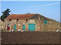
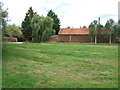
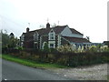
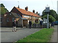
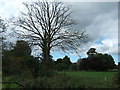
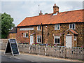
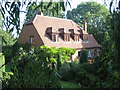
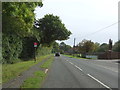
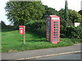
Photos of PE32 1DH

Area Information
Living in PE32 1DH means residing in a compact residential cluster defined by a specific postcode covering exactly 4,585 square metres. This small area houses a population of 1,128 people, creating a relatively low-density environment with just 90 people per square kilometre. The setting is intimate yet connected, situated within the broader context of Kings Lynn in England. Residents enjoy a quiet domestic atmosphere shaped by this limited land mass, which keeps the local community close-knit. Unlike sprawling suburban districts, the density here forces a familiarity with neighbours and local landmarks. The postcode represents a focused zone where daily life revolves around immediate access to nearby villages and town centres rather than vast distances. You will find that the scale of PE32 1DH allows for an unhurried pace of life while maintaining essential services within a practical commute. This area offers a stable living environment for those seeking a settled home outside major urban congestion. The specific boundaries of this postcode create a distinct micro-community character that differs significantly from the wider surrounding region.
- Area Type
- Postcode
- Area Size
- 4585 m²
- Population
- 1128
- Population Density
- 90 people/km²
The property market in PE32 1DH is overwhelmingly an owner-occupied sector, with 84% of homes held by occupants who intend to stay long-term. This high ownership rate contrasts sharply with rental-heavy urban centres and points to a market driven by settled buyers rather than transient tenants. The predominant accommodation type consists of houses, meaning the housing stock likely features detached or semi-detached dwellings rather than flats or apartments. This structural preference aligns with the family-oriented demographic profile and the desire for space within a low-density environment. For buyers examining homes in PE32 1DH, the scarcity of rental properties means the market focuses on sale and leaseback transactions. The small area size of 4,585 square metres limits the sheer volume of available stock, making each property listing significant. You will find that competition for these homes may be high due to the limited supply and strong desire to own a permanent residence. This market dynamic supports capital stability and community continuity. Existing residents typically renovate and upgrade their properties rather than moving frequently, further cementing the owner-led nature of the local estate.
House Prices in PE32 1DH
Showing 9 properties
| Address | Type | Beds | Baths | Last Sale Price | Last Sale Date | |
|---|---|---|---|---|---|---|
| 2 Nursery Close, Pott Row, PE32 1DH | Bungalow | 2 | 1 | - | - | |
| 4 Nursery Close, Pott Row, PE32 1DH | Bungalow | 3 | - | - | - | |
| 7 Nursery Close, Pott Row, PE32 1DH | Bungalow | - | - | - | - | |
| 6 Nursery Close, Pott Row, PE32 1DH | Semi-detached | - | - | - | - | |
| 9 Nursery Close, Pott Row, PE32 1DH | Bungalow | - | - | - | - | |
| 1 Nursery Close, Pott Row, PE32 1DH | Semi-detached | - | - | - | - | |
| 8 Nursery Close, Pott Row, PE32 1DH | Semi-detached | - | - | - | - | |
| 5 Nursery Close, Pott Row, PE32 1DH | Detached | - | - | - | - | |
| 3 Nursery Close, Pott Row, PE32 1DH | Detached | - | - | - | - |
Energy Efficiency in PE32 1DH
Residents of PE32 1DH benefit from convenient access to a range of retail, rail, and ferry amenities within practical reach. For everyday shopping, you can visit Asda South, Tesco South, and Morrisons Daily Kings, ensuring essential groceries and household goods are easily sourced. These five main retail outlets provide sufficient variety for daily needs without requiring long drives. Transport links include Kings Lynn Railway Station, which offers regular rail connections to surrounding towns and cities. Additionally, two ferry landing points, King's Lynn Ferry Landing and West Lynn Ferry Landing, provide water-based transport options for leisure or specific commuter needs. This mix of rail and ferry access diversifies your travel methods and adds flexibility to your daily routine. The proximity of these amenities means you do not need to travel far for most activities. Shopping trips, train journeys, and short crossings are all manageable from this location. The presence of both supermarket chains and a railway station establishes PE32 1DH as a functional base for independent living. Residents enjoy a lifestyle where work, leisure, and essential services are balanced by reasonable travel distances.
Amenities
Schools
Families living in PE32 1DH have access to Pott Row First School, which serves as the primary educational institution in the immediate vicinity. This primary school caters to younger children who require foundational education before transitioning to secondary institutions elsewhere in the Kings Lynn area. The presence of a named primary school indicates that the area supports early childhood and elementary education needs directly. While secondary school options are not listed in the immediate data for this postcode, the primary provision ensures local access for young families. The single primary school mentioned suggests a close community environment where schools play a central role in local social life. Parents can rely on Pott Row First School as the first educational step for their children. This arrangement is typical for smaller clusters where primary education is decentralised. Prospective buyers should note that while this primary facility is available, planning for secondary education may require reviewing catchment areas beyond the immediate postcode. The quality of education depends on the school's performance data, which relates directly to local student outcomes and community reputation.
| Rank | School | Type | Entry gender | Ages |
|---|
Explore more schools in this area
Go to Schools tabDemographics
The community in PE32 1DH reflects a mature and established population, with a median age of 47 years. Most residents fall within the 30 to 64-year-old age range, indicating a cohort likely focused on family stability and long-term settlement. Home ownership stands at 84%, a figure that speaks to long-term residency and financial investment in the local property stock. This high rate of ownership suggests a deliberate choice to put down roots rather than renting transient accommodation. The accommodation type is predominantly houses, aligning with the needs of families and individuals seeking traditional living spaces. While the predominant ethnic group is white, the area respects the diversity inherent in such specific residential clusters. There is no indication of severe deprivation affecting daily quality of life within these statistics. The demographic profile points to a stable neighbourhood where residents have chosen to stay for extended periods. This consistency in population structure means you can expect a community with established routines and local knowledge. The age distribution also implies a period of retirement or semi-retirement activity is present within the cohort.
Household Size
Accommodation Type
Tenure
Ethnic Group
Religion
Household Composition
Age
Household Deprivation
NS-SEC
Explore more demographic insights in this area
Go to Demographics tabPlanning
Planning Constraints
- Flood RiskPremium
- Ramsar Wetland SitesPremium
- Area of Outstanding Natural BeautyPremium
- Protected Nature ReservePremium
- Protected WoodlandPremium
- Crime & SafetyPremium