Area Overview for PE30 4DX
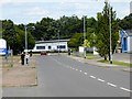
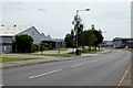
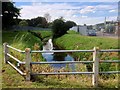
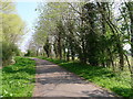
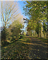
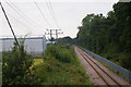
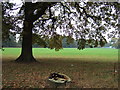
Photos of PE30 4DX

Area Information
PE30 4DX is a small residential cluster located in England, defined entirely by its postcode boundary. This specific area covers just 1.9 hectares and is home to 2,044 residents. The population density stands at 1,310 people per square kilometre, indicating a compact settlement where neighbours are likely to know each other. Living in PE30 4DX means you reside in a tightly knit community where space is at a premium compared to wider rural expanses. The area functions as a distinct living zone within the Kings Lynn landscape, offering a concentrated environment rather than sprawling neighbourhoods. Its size creates a sense of intimacy, with daily activities likely centred on a tight radius from your property. You are part of a defined group of approximately two thousand households sharing a very specific postcode. The demographic profile suggests a standard residential mix, though the lack of more detailed household breakdowns in the core data means you must look to local knowledge networks for precise community portraits. The area is not defined by grand parks or unique landmarks but by its practical footprint and its integration into the broader local transport and retail networks. For those considering homes in PE30 4DX, the reality is a straightforward, high-density option within a functional English county setting.
- Area Type
- Postcode
- Area Size
- 1.9 hectares
- Population
- 2044
- Population Density
- 1310 people/km²
The property market in PE30 4DX is characterised by its limited physical footprint and high residential density. With only 1.9 hectares of land supporting 2,044 people, the housing stock is concentrated, making competition for specific properties within the exact postcode potentially intense. The area is not dominated by a single type of accommodation, but rather serves as a general residential cluster typical of the Kings Lynn region. Buyers looking at homes in this postcode should expect a mix of properties, with the majority likely being owner-occupied given the standard nature of such clusters in English county towns. The high population density of 1,310 people per square kilometre suggests most dwellings are relatively small-scale, such as terraced houses, semi-detached properties, or flats. There are no protected woodland or nature reserve constraints limiting new builds, which historically allowed for steady development and turnover in the local stock. Safety considerations are moderate, with a crime risk level described as a warning, indicating standard security precautions are necessary for all residents. Understanding this market means recognising that availability will be low, and the properties you compete for will be ready for immediate occupation. The area offers a practical option for those who prioritise proximity to amenities over spacious grounds.
House Prices in PE30 4DX
Showing 1 properties
| Address | Type | Beds | Baths | Last Sale Price | Last Sale Date | |
|---|---|---|---|---|---|---|
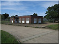
| City Electrical Factors Ltd, Rollesby Road, Hardwick Industrial Estate, Kings Lynn, PE30 4DX | storage_distribution | - | - | - | - |
Energy Efficiency in PE30 4DX
Daily life in PE30 4DX revolves around a compact set of amenities within easy walking or short driving distance. Retail options include five local convenience stores, with Sainsburys Kings, Iceland Kings, and Spar being the most notable providers for everyday groceries and essentials. Dining out requires a short trip, but you are situated close enough to access a range of local eateries and cafes that serve the broader Kings Lynn population. Transport hubs significantly enhance your lifestyle, with Kings Lynn Railway Station and Watlington Railway Station located nearby for regular train journeys. If you require water crossings, two ferry landings are available at King's Lynn Ferry Landing and West Lynn Ferry Landing, linking you to the region's wider transport web. The area size of 1.9 hectares ensures you are close to these facilities, yet the 1,310 people per square kilometre density means the streets can be busy during peak hours. There are no protected nature reserves within the immediate boundary, so your leisure time likely focuses on local parks or trips to the surrounding countryside beyond the postcode. This practical layout supports a lifestyle focused on convenience and quick access to public services.
Amenities
Schools
| Rank | School | Type | Entry gender | Ages |
|---|
Explore more schools in this area
Go to Schools tabDemographics
Understanding the community in PE30 4DX requires looking at how approximately 2,044 individuals are distributed across the 1.9 hectares of available land. The population density of 1,310 people per square kilometre reflects a significant concentration of households in a very small footprint. This high density often correlates with a mix of homeowners and rental occupants, though specific ownership percentages are not detailed in the available figures. The area does not sit within a Ramsar wetland site, nor is it covered by an Area of Outstanding Natural Beauty or any protected nature reserve or woodland. These planning constraints pass without issue, suggesting the local land use is flexible for development but currently supports stable residential patterns. The demographics lack specific age breakdowns, so the area likely contains a blend of families, professionals, and retirees typical of a mid-density English county postcode. Living in this cluster means you share the space with over a thousand other neighbours in a contiguous zone. The community feel is shaped by this proximity, creating a neighbourhood where local events and infrastructure serve a dense population efficiently.
Household Size
Accommodation Type
Tenure
Ethnic Group
Religion
Household Composition
Age
Household Deprivation
NS-SEC
Explore more demographic insights in this area
Go to Demographics tabPlanning
Planning Constraints
- Flood RiskPremium
- Ramsar Wetland SitesPremium
- Area of Outstanding Natural BeautyPremium
- Protected Nature ReservePremium
- Protected WoodlandPremium