Area Overview for PE3 8LA
Photos of PE3 8LA
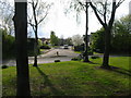
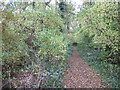
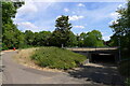
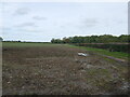
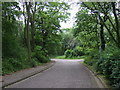
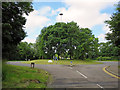
7 photos from this area
Area Information
Key information about the PE3 8LA including its size, population, and administrative classification.
- Area Type
- Postcode
- Area Size
- 2.8 hectares
- Population
- 1505
- Population Density
- 3649 people/km²
House Prices in PE3 8LA
50
Properties
£203,955
Average Sold Price
£64,500
Lowest Price
£378,000
Highest Price
Showing 50 properties
| Address | Type | Beds | Baths | Last Sale Price | Last Sale Date | |
|---|---|---|---|---|---|---|
| 53 Dunsberry, Bretton, Peterborough, PE3 8LA | Detached | 4 | 2 | £378,000 | Oct 2025 | |
| 12 Dunsberry, Bretton, Peterborough, PE3 8LA | Semi-detached | 3 | 1 | £260,000 | Nov 2024 | |
| 47 Dunsberry, Bretton, Peterborough, PE3 8LA | Detached | 4 | 1 | £315,000 | Jul 2024 | |
| 49 Dunsberry, Bretton, Peterborough, PE3 8LA | Detached | 4 | 1 | £365,000 | Jul 2024 | |
| 11 Dunsberry, Bretton, Peterborough, PE3 8LA | Semi-detached | 4 | 1 | £260,500 | Mar 2024 | |
| 13 Dunsberry, Bretton, Peterborough, PE3 8LA | Chalet | 3 | 2 | £175,000 | Feb 2024 | |
| 14 Dunsberry, Bretton, Peterborough, PE3 8LA | house | - | - | £230,000 | Nov 2023 | |
| 30 Dunsberry, Bretton, Peterborough, PE3 8LA | house | - | - | £295,000 | Sep 2021 | |
| 15 Dunsberry, Bretton, Peterborough, PE3 8LA | Semi-detached | 5 | 1 | £265,000 | Aug 2021 | |
| 46 Dunsberry, Bretton, Peterborough, PE3 8LA | Detached | 4 | 1 | £265,000 | Feb 2020 |
Page 1 of 5
Energy Efficiency in PE3 8LA
Amenities
Schools
| Rank | School | Type | Entry gender | Ages |
|---|
Explore more schools in this area
Go to Schools tabDemographics
Household Size
Two person
most common
Accommodation Type
Houses
most common
Tenure
72
majority
Ethnic Group
White
most common
Religion
N/A
most common
Household Composition
N/A
most common
Age
47
median
Adults (30-64 years)
most common
Household Deprivation
N/A
with no deprivation
NS-SEC
30
in Lower managerial occupations
Explore more demographic insights in this area
Go to Demographics tabPlanning
Planning Constraints
- Flood RiskPremium
- Ramsar Wetland SitesPremium
- Area of Outstanding Natural BeautyPremium
- Protected Nature ReservePremium
- Protected WoodlandPremium