Area Overview for PE3 7LL
Photos of PE3 7LL
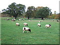
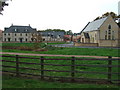
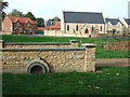

25 photos from this area
Area Information
Key information about the PE3 7LL including its size, population, and administrative classification.
- Area Type
- Postcode
- Area Size
- 1.2 hectares
- Population
- 1510
- Population Density
- 8079 people/km²
House Prices in PE3 7LL
43
Properties
£109,418
Average Sold Price
£17,110
Lowest Price
£190,000
Highest Price
Showing 43 properties
| Address | Type | Beds | Baths | Last Sale Price | Last Sale Date | |
|---|---|---|---|---|---|---|
| 28 Deaconscroft, Ravensthorpe, Peterborough, PE3 7LL | Terraced | 1 | 1 | £148,265 | Oct 2024 | |
| 39 Deaconscroft, Ravensthorpe, Peterborough, PE3 7LL | Terraced | 3 | 1 | £185,000 | Apr 2024 | |
| 22 Deaconscroft, Ravensthorpe, Peterborough, PE3 7LL | house | - | - | £160,000 | Dec 2023 | |
| 3 Deaconscroft, Ravensthorpe, Peterborough, PE3 7LL | Terraced | 3 | 1 | £190,000 | May 2023 | |
| 10 Deaconscroft, Ravensthorpe, Peterborough, PE3 7LL | Terraced | 3 | 1 | £140,000 | May 2023 | |
| 6 Deaconscroft, Ravensthorpe, Peterborough, PE3 7LL | house | - | - | £100,000 | Dec 2020 | |
| 30 Deaconscroft, Ravensthorpe, Peterborough, PE3 7LL | Terraced | 3 | 1 | £147,500 | Sep 2019 | |
| 17 Deaconscroft, Ravensthorpe, Peterborough, PE3 7LL | house | - | - | £140,000 | Jun 2019 | |
| 26 Deaconscroft, Ravensthorpe, Peterborough, PE3 7LL | Terraced | 3 | 1 | £150,000 | Jun 2019 | |
| 27 Deaconscroft, Ravensthorpe, Peterborough, PE3 7LL | Terraced | 3 | 2 | £144,000 | Mar 2019 |
Page 1 of 5
Energy Efficiency in PE3 7LL
Amenities
Schools
| Rank | School | Type | Entry gender | Ages |
|---|
Explore more schools in this area
Go to Schools tabDemographics
Household Size
Family (3-5 people)
most common
Accommodation Type
Houses
most common
Tenure
49
majority
Ethnic Group
White
most common
Religion
N/A
most common
Household Composition
N/A
most common
Age
47
median
Adults (30-64 years)
most common
Household Deprivation
N/A
with no deprivation
NS-SEC
16
in Lower managerial occupations
Explore more demographic insights in this area
Go to Demographics tabPlanning
Planning Constraints
- Flood RiskPremium
- Ramsar Wetland SitesPremium
- Area of Outstanding Natural BeautyPremium
- Protected Nature ReservePremium
- Protected WoodlandPremium