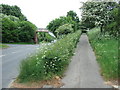
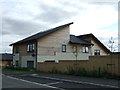
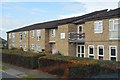
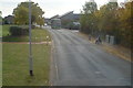
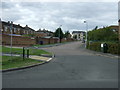
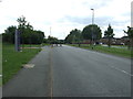
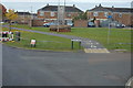
Area Overview for PE29 7AL
Photos of PE29 7AL


Area Information
Living in PE29 7AL means residing in a defined residential cluster situated in Huntingdon, Cambridgeshire. This specific postcode covers just over two hectares, extending 2119 square metres across the landscape. A population of 1346 people calls this small area home, creating a relatively compact neighbourhood where residents likely know their neighbours. You are buying into a community with a clear residential focus, typical of the Huntingdon bailiwick. The area offers the stability of a settled village life while remaining functionally connected to the wider Huntingdon town and surrounding regions. Daily life here involves a reliance on local proximity and established routes rather than grand metropolitan infrastructure. The space is intimate, allowing for a sense of community that larger postcodes often lack. Prospective buyers seeking a specific pocket within the broader Huntingdon area will find PE29 7AL to be that distinct, manageable slice of real estate. It is a location defined by its size and its position within the established housing patterns of the borough, offering a respite from the sprawl of larger urban developments.
- Area Type
- Postcode
- Area Size
- 2119 m²
- Population
- 1346
- Population Density
- 3822 people/km²
The property market in PE29 7AL is characterised by a specific housing stock and ownership structure that influences buyer expectations. Houses constitute the primary accommodation type across this postcode, meaning you will not find high-rise flats or semi-detached terraces as the dominant options. This housing typology suggests a suburbia built around detached or semi-detached family homes with gardens, typical of the Huntingdon region. With 46 per cent of the population owning their homes, there is a substantial vested interest in the local property values and community upkeep. This indicates a market where ownership is common but not universal, leaving room for a healthy rental sector alongside owner-occupied residences. Buyers looking at homes in PE29 7AL should anticipate access to larger plots and traditional British house designs rather than the density found in city towns. The small area size of 2119 square metres limits the volume of transactions, suggesting a stable and perhaps slower-moving market. For those eyeing houses in PE29 7AL, the focus is often on condition and garden space, as the stock type rarely necessitates interior scale. Understanding that this is a house-centric market helps you target your search effectively without wasting time on property types this postcode does not support.
House Prices in PE29 7AL
Showing 12 properties
| Address | Type | Beds | Baths | Last Sale Price | Last Sale Date | |
|---|---|---|---|---|---|---|
| 9, Oaklands House, Elm Close, Huntingdon, PE29 7AL | Flat | 1 | 1 | £107,500 | May 2022 | |
| 11, Oaklands House, Elm Close, Huntingdon, PE29 7AL | Flat | - | - | - | - | |
| 6, Oaklands House, Elm Close, Huntingdon, PE29 7AL | Flat | - | - | - | - | |
| 7, Oaklands House, Elm Close, Huntingdon, PE29 7AL | Flat | - | - | - | - | |
| 10, Oaklands House, Elm Close, Huntingdon, PE29 7AL | Flat | - | - | - | - | |
| 5, Oaklands House, Elm Close, Huntingdon, PE29 7AL | Flat | - | - | - | - | |
| 3, Oaklands House, Elm Close, Huntingdon, PE29 7AL | Flat | - | - | - | - | |
| 8, Oaklands House, Elm Close, Huntingdon, PE29 7AL | Flat | - | - | - | - | |
| 4, Oaklands House, Elm Close, Huntingdon, PE29 7AL | Flat | - | - | - | - | |
| 1, Oaklands House, Elm Close, Huntingdon, PE29 7AL | Flat | - | - | - | - |
Energy Efficiency in PE29 7AL
Your lifestyle in PE29 7AL revolves around a cluster of practical amenities within practical reach. Five notable retail locations serve the area, including Lidl Hinchingbrooke, Sainsburys Huntingdon, and Tesco Stukeley. These supermarkets provide the essentials for daily cooking and household provisioning without requiring a long journey into town. For commuters, Huntingdon Railway Station offers direct rail links to wider networks, making PE29 7AL accessible for those who do not work locally. If air travel is part of your routine, RAF Wyton serves as the nearest airport facility, providing access to international and domestic flights. While this is a military airport, it remains the primary aviation hub for the immediate proximity of the postcode. The combination of major grocery retailers and transport hubs ensures that daily conveniences are highly accessible. Residents can manage their weekly shop, catch a train for work, or fly for weekend breaks without extensive travel planning. This blend of retail and transport options defines the practical lifestyle of PE29 7AL, offering independence from the centre of town for most daily errands.
Amenities
Schools
Families living in PE29 7AL have access to educational institutions that serve the immediate local community. The nearest primary education options include St John's CofE Primary School, which stands as the designated local primary provider listed for this area. This is a Church of England school, reflecting the established historical and religious fabric of the Huntingdon region. The data indicates this school serves the immediate catchment, though no secondary schools are listed within the direct vicinity of the postcode. For residents, this means that younger children are educated at PE29 7AL's closest primary facility before potentially transferring to secondary schools further away in Huntingdon. The presence of St John's CofE Primary School anchors the educational landscape for those seeking schools near PE29 7AL. While the local authority may have moved other institutions further from this small enclave, St John's remains the key fixture for early education. Parents must plan their child's education path carefully, acknowledging that the primary stage is localised while secondary options require a commute. This specific school configuration is a central piece of information for any prospective homebuyer evaluating the PE29 7AL area for child-rearing families.
| Rank | School | Type | Entry gender | Ages |
|---|
Explore more schools in this area
Go to Schools tabDemographics
The community within PE29 7AL is defined by a mature demographic profile, with a median age of 47 years. Most residents fall into the adult bracket spanning 30 to 64 years old, suggesting a neighbourhood that has seen significant family growth and stability over recent decades. Home ownership stands at 46 per cent, indicating a balanced mix of owners and renters, though this figure is lower than the national average for similar village locations. The predominant accommodation type consists of houses, reinforcing the suburban character of the postcode. Ethnically, the area is predominantly White, reflecting the traditional makeup of many historical settlements in Cambridgeshire. You can expect a neighbourhood where families have roots in the local area, often passing properties down through generations. This age profile suggests a quieter environment compared to areas dominated by students or young professionals. The high median age implies that services and amenities cater more to established households than to transient populations. Families looking for a settled environment with long-term residents will find the demographic makeup of PE29 7AL to be a significant draw, offering a predictable and stable community atmosphere.
Household Size
Accommodation Type
Tenure
Ethnic Group
Religion
Household Composition
Age
Household Deprivation
NS-SEC
Explore more demographic insights in this area
Go to Demographics tabPlanning
Planning Constraints
- Flood RiskPremium
- Ramsar Wetland SitesPremium
- Area of Outstanding Natural BeautyPremium
- Protected Nature ReservePremium
- Protected WoodlandPremium