Area Overview for PE29 3TH
Photos of PE29 3TH


Area Information
Living in PE29 3TH means residing within a tightly knit residential cluster spanning 653 square metres. This postcode covers a specific population of 1,323 individuals, creating a compact neighbourhood where daily routines are centred on the immediate vicinity. The area is located in England and functions as a distinct housing pocket rather than a sprawling district. Residents enjoy a population density of 1,020 people per square kilometre, which fosters an immediate sense of community while maintaining reasonable personal space. The demographic profile suggests a community dominated by adults aged between 30 and 64 years, indicating a settlement built around established households rather than transient populations. Daily life here revolves around proximity, with essential services and transport links situated within practical reach. Although small in physical footprint, the location connects directly to the wider Huntingdon area through nearby retail options and rail connections. You will find yourself in a setting that balances residential privacy with easy access to broader urban amenities, making it suitable for those who prioritise location efficiency over large garden plots or expansive communal spaces.
- Area Type
- Postcode
- Area Size
- 653 m²
- Population
- 1323
- Population Density
- 1020 people/km²
The property market in PE29 3TH is defined by a lightweight asset base comprising 653 square metres of residential space. The housing stock is dominated by flats, which dictates the form of homes available for purchase or rent in this specific postcode. With only 37 per cent of residents owning their homes, the area functions primarily as a rental market rather than an owner-occupied district. This low ownership percentage suggests a high turnover of tenants and properties, often characteristic of areas popular with commuters or professionals seeking flexibility. You should approach the market here with the expectation that most transactions will involve tenancies, though purchase opportunities for flats do exist. The small geographical scale of the area means that property values and types are heavily influenced by the immediate proximity to Huntingdon's main transport and retail hubs. Unlike sprawling suburban developments where you might find rows of detached houses, this cluster offers compact living solutions. Buyers looking for homes in PE29 3TH must accept the reality of a rental-heavy environment where investment properties and long-term leases are more common than family-owned homes.
House Prices in PE29 3TH
No properties found in this postcode.
Energy Efficiency in PE29 3TH
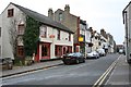
Your lifestyle in PE29 3TH is supported by a practical network of amenities within practical reach. Retail options include M&S Huntingdon, Iceland Huntingdon, and Sainsburys Huntingdon, ensuring you have access to full-range supermarkets and daily necessities without needing to travel far. These specific venues provide the bulk of your shopping requirements, reducing the need for car dependency for simple grocery runs. Transport links are robust, with Huntingdon Railway Station located nearby to facilitate your daily commute across the wider network. For residents who work in aviation or relevant sectors, RAF Wyton is also a notable landmark nearby, indicating a diverse local economy. The combination of major supermarket chains and a railway station creates a convenient urban feel despite the small size of the residential cluster. You do not have to traverse long distances for essentials, as the area is surrounded by these key commercial and transport nodes. This layout supports a walkable life where your morning coffee or evening meal can be sourced from local chains, all while keeping your rail journey to central hubs minimal.
Amenities
Schools
Families considering PE29 3TH have access to Hinchingbrooke School, which appears in the local educational landscape in two distinct capacities. The facility operates as both a primary school and, separately, as an academy. Crucially, the academy iteration holds a good Ofsted rating, providing a reliable standard for the education available to children living in the postcode. The dual presence of this institution suggests a comprehensive catchment area where local children remain within the same educational framework from primary years through to their secondary education. This proximity means parents do not face significant travel logistics for school runs, as the institution is situated near the residential cluster. For prospective homebuyers, the school options are limited by the data provided, focusing entirely on this single named provider. There are no other schools listed for this area, meaning your choices for education are concentrated around Hinchingbrooke School. The good rating of the academy element is a positive indicator for the quality of instruction your children would receive, regardless of the specific phase of education they are currently undertook.
| Rank | School | Type | Entry gender | Ages |
|---|
Explore more schools in this area
Go to Schools tabDemographics
The community in PE29 3TH reflects a mature population with a median age of 47. Overwhelmingly, the residents fall into the 30-64 year age bracket, suggesting a neighbourhood populated by grown-up households rather than young families or students. Accommodation types indicate a strong preference for flats, meaning the built environment likely consists predominantly of apartments or converted residential blocks rather than detached houses. This structural reality aligns with a home ownership rate of just 37 per cent. Consequently, the majority of residents in this specific cluster rent their properties rather than own them outright. The predominant ethnic group is White, reflecting the traditional demographic character of this part of Huntingdon. These figures combine to paint a picture of a settled, adult community where rental living is the standard mode of residence. The lack of statistical data on income or deprivation means one must rely on these core indicators to understand the social fabric. The high concentration of adult renters in flats suggests a market driven by temporary or mid-term stays, professional relocations, or lifestyle choices favouring urban-style living within a semi-urban setting.
Household Size
Accommodation Type
Tenure
Ethnic Group
Religion
Household Composition
Age
Household Deprivation
NS-SEC
Explore more demographic insights in this area
Go to Demographics tabPlanning
Planning Constraints
- Flood RiskPremium
- Ramsar Wetland SitesPremium
- Area of Outstanding Natural BeautyPremium
- Protected Nature ReservePremium
- Protected WoodlandPremium