Area Overview for PE29 3BU
Photos of PE29 3BU
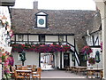
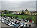
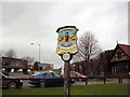
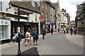
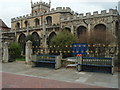
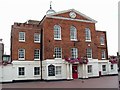
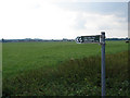
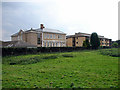
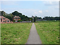
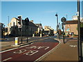

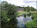
100 photos from this area
Area Information
Key information about the PE29 3BU including its size, population, and administrative classification.
- Area Type
- Postcode
- Area Size
- 7267 m²
- Population
- 1126
- Population Density
- 5175 people/km²
House Prices in PE29 3BU
27
Properties
£174,606
Average Sold Price
£58,500
Lowest Price
£282,000
Highest Price
Showing 27 properties
| Address | Type | Beds | Baths | Last Sale Price | Last Sale Date | |
|---|---|---|---|---|---|---|
| 9 Ferrars Court, Huntingdon, PE29 3BU | Terraced | 3 | 2 | £282,000 | Oct 2022 | |
| 23 Ferrars Court, Huntingdon, PE29 3BU | Semi-detached | 3 | 2 | £250,000 | Nov 2021 | |
| 24 Ferrars Court, Huntingdon, PE29 3BU | Semi-detached | 3 | - | £232,000 | Feb 2021 | |
| 15 Ferrars Court, Huntingdon, PE29 3BU | Maisonette | 2 | 1 | £155,000 | May 2019 | |
| 6 Ferrars Court, Huntingdon, PE29 3BU | Terraced | 3 | 2 | £240,000 | Feb 2019 | |
| 13 Ferrars Court, Huntingdon, PE29 3BU | Semi-detached | 3 | 2 | £249,950 | Sep 2018 | |
| 4 Ferrars Court, Huntingdon, PE29 3BU | Semi-detached | 3 | 1 | £245,000 | Sep 2016 | |
| 3 Ferrars Court, Huntingdon, PE29 3BU | Semi-detached | 3 | 2 | £242,000 | Aug 2016 | |
| 12 Ferrars Court, Huntingdon, PE29 3BU | house | 3 | 2 | £145,000 | Mar 2016 | |
| 5 Ferrars Court, Huntingdon, PE29 3BU | Terraced | 4 | 2 | £208,000 | Jan 2016 |
Page 1 of 3
Energy Efficiency in PE29 3BU
Amenities
Schools
| Rank | School | Type | Entry gender | Ages |
|---|
Explore more schools in this area
Go to Schools tabDemographics
Household Size
One person
most common
Accommodation Type
Flats
most common
Tenure
41
majority
Ethnic Group
White
most common
Religion
N/A
most common
Household Composition
N/A
most common
Age
47
median
Adults (30-64 years)
most common
Household Deprivation
N/A
with no deprivation
NS-SEC
35
in Lower managerial occupations
Explore more demographic insights in this area
Go to Demographics tabPlanning
Planning Constraints
- Flood RiskPremium
- Ramsar Wetland SitesPremium
- Area of Outstanding Natural BeautyPremium
- Protected Nature ReservePremium
- Protected WoodlandPremium