Area Overview for PE29 2WW
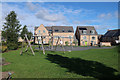
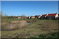
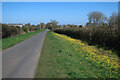
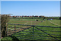
Photos of PE29 2WW
Area Information
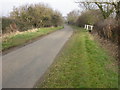
The postcode PE29 2WW occupies a specific residential cluster covering just 5,355 square metres. Despite its compact size, this area is home to a population of 1,654 people, creating a neighbourhood with a distinct density. You will find that daily life here centres on a tightly knit community where residents often know their neighbours. The area functions as a small, focused hub within the wider Huntingdon region, offering a sense of stability and quiet. Living in PE29 2WW means accessing a home environment that is substantial in spirit despite its limited land area. The immediate surroundings are designed for close-knit living rather than sprawling expansion. This postcode serves as a gateway to the town of Huntingdon, allowing you to enjoy the Practicality of a village setting with the infrastructure of a nearby market town. You can attend local gatherings or walk to nearby facilities without needing to travel far for basic needs. The residential nature of the area ensures that noise and traffic remain manageable, supporting a peaceful way of life for families and individuals alike.
- Area Type
- Postcode
- Area Size
- 5355 m²
- Population
- 1654
- Population Density
- 4676 people/km²
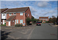
The property market in PE29 2WW is characterised by its strong leaning towards owner-occupation. With 74 per cent of households owning their property outright or with a mortgage, the area offers a secure environment for buyers. This statistic stands in contrast to modern cities where rental markets dominate, making PE29 2WW an attractive option for those seeking roots. The local stock consists primarily of houses, which appeals to families needing separate rooms and outdoor space. You will find that homes in this postcode are generally freehold properties, meaning you hold the title to the land the building sits on. The accommodation type data confirms that you are not looking for flats or shared houses, but detached or semi-detached structures typical of the English countryside or suburban fringe. This housing stock provides a predictable market where property values remain steady over time. Buying homes in PE29 2WW often requires a commitment to maintenance, as these are standalone residential units rather than managed blocks. The low rental trend you see here suggests that once you move in, staying is the norm.
House Prices in PE29 2WW
No properties found in this postcode.
Energy Efficiency in PE29 2WW
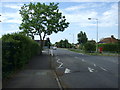
Life in PE29 2WW offers convenient access to key amenities within reasonable travel distance. Retail options are well-supported, with five notable retail locations nearby. You can shop at the Co-op Godmanchester or the M&S Huntingdon. These specific venues provide everything from groceries to clothing, cutting down your need for long shopping trips. Fresh food and daily essentials are always available to you. Transport links are equally practical for your daily commute. The Huntingdon Railway Station serves as the primary rail hub, connecting you to the wider national network. For aviation needs, RAF Wyton is listed as an airport amenity. While you may not visit a commercial airport daily, the presence of these transport nodes ensures you can travel for work or leisure with ease. The concentration of these amenities means that your local shopping and transport needs are met without extensive travel times. Living in this area gives you the convenience of town facilities while retaining the peace of a residential zone.
Amenities
Schools
Families living in PE29 2WW have access to quality local education through public institutions. The nearest listed school is St Anne's CofE Primary School. This institution falls under the maintained sector and operates as a Church of England primary school. The school holds a 'good' rating from Ofsted, which indicates that it meets high standards in education and care for young children. This single-referenced schooling option simplifies your choices if you are looking at primary education for younger children. The 'good' rating reassures parents about the curriculum and the environment their children will experience daily. While the data only provides information on this primary institution, its presence within the immediate vicinity of the postcode suggests that local nurseries or catchment areas extend beyond these walls. You can expect a community that values traditional schooling options for its residents. The specific mix of school types is heavily weighted towards the primary level, offering a head start before students transfer to secondary institutions further afield.
| Rank | School | Type | Entry gender | Ages |
|---|
Explore more schools in this area
Go to Schools tabDemographics
The community in PE29 2WW is defined by stability and maturity. Residents tend to be settled into their homes, with 74 per cent of the population being homeowners. This high ownership rate suggests a long-term commitment to the area and a preference for the stability of buying rather than renting. The predominant accommodation type consists of houses, reflecting a family-oriented environment where people have space for gardens and outside areas. Age plays a significant role in who lives here. The median age is 47 years, indicating that the neighbourhood attracts ageing well into mid-life and early retirement. The most common age range for residents falls between 30 and 64 years. This demographic profile creates a practical, adult atmosphere where the house price reflects the demand from families and professionals seeking a reliable base. The predominant ethnic group is White, which contributes to the traditional character of the street scene. You will find a community that values continuity and mutual support, as seen in the lack of turn-over typical of younger, transient settlements.
Household Size
Accommodation Type
Tenure
Ethnic Group
Religion
Household Composition
Age
Household Deprivation
NS-SEC
Explore more demographic insights in this area
Go to Demographics tabPlanning
Planning Constraints
- Flood RiskPremium
- Ramsar Wetland SitesPremium
- Area of Outstanding Natural BeautyPremium
- Protected Nature ReservePremium
- Protected WoodlandPremium