Area Overview for PE27 6DR
Photos of PE27 6DR
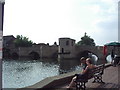
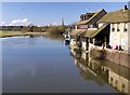
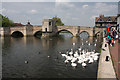
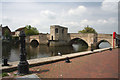
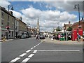
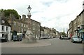
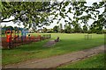
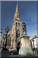
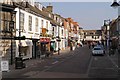
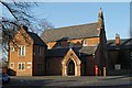
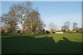
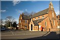
100 photos from this area
Area Information
Key information about the PE27 6DR including its size, population, and administrative classification.
- Area Type
- Postcode
- Area Size
- 1.8 hectares
- Population
- 2248
- Population Density
- 2159 people/km²
House Prices in PE27 6DR
34
Properties
£232,467
Average Sold Price
£57,000
Lowest Price
£395,000
Highest Price
Showing 34 properties
| Address | Type | Beds | Baths | Last Sale Price | Last Sale Date | |
|---|---|---|---|---|---|---|
| 11 Whitecross, St Ives, PE27 6DR | Semi-detached | 4 | 1 | £360,000 | Jan 2024 | |
| 23 Whitecross, St Ives, PE27 6DR | Semi-detached | 4 | 1 | £360,000 | Oct 2023 | |
| 19 Whitecross, St Ives, PE27 6DR | Semi-detached | 4 | 1 | £395,000 | Dec 2022 | |
| 8 Whitecross, St Ives, PE27 6DR | house | - | - | £280,000 | Mar 2020 | |
| 24 Whitecross, St Ives, PE27 6DR | Semi-detached | 3 | 1 | £300,000 | Aug 2019 | |
| 32 Whitecross, St Ives, PE27 6DR | Semi-detached | 4 | 1 | £270,000 | Sep 2018 | |
| 21 Whitecross, St Ives, PE27 6DR | Semi-detached | 4 | 1 | £300,000 | Jun 2018 | |
| 33 Whitecross, St Ives, PE27 6DR | house | - | - | £185,000 | Nov 2012 | |
| 26 Whitecross, St Ives, PE27 6DR | house | - | - | £185,000 | Jun 2012 | |
| 15 Whitecross, St Ives, PE27 6DR | house | - | - | £205,000 | Dec 2010 |
Page 1 of 4
Energy Efficiency in PE27 6DR
Amenities
Schools
| Rank | School | Type | Entry gender | Ages |
|---|
Explore more schools in this area
Go to Schools tabDemographics
Household Size
Family (3-5 people)
most common
Accommodation Type
Houses
most common
Tenure
67
majority
Ethnic Group
White
most common
Religion
N/A
most common
Household Composition
N/A
most common
Age
47
median
Adults (30-64 years)
most common
Household Deprivation
N/A
with no deprivation
NS-SEC
39
in Lower managerial occupations
Explore more demographic insights in this area
Go to Demographics tabPlanning
Planning Constraints
- Flood RiskPremium
- Ramsar Wetland SitesPremium
- Area of Outstanding Natural BeautyPremium
- Protected Nature ReservePremium
- Protected WoodlandPremium