Area Overview for PE27 6AA
Photos of PE27 6AA
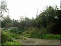
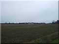
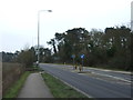
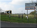
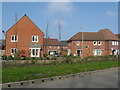
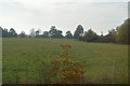
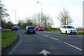
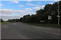
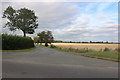
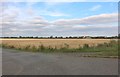
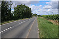
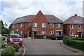
23 photos from this area
Area Information
Key information about the PE27 6AA including its size, population, and administrative classification.
- Area Type
- Postcode
- Area Size
- 9305 m²
- Population
- 1622
- Population Density
- 1780 people/km²
House Prices in PE27 6AA
30
Properties
£241,999
Average Sold Price
£131,000
Lowest Price
£400,000
Highest Price
Showing 30 properties
| Address | Type | Beds | Baths | Last Sale Price | Last Sale Date | |
|---|---|---|---|---|---|---|
| 21 Garner Drive, St Ives, PE27 6AA | Semi-detached | 3 | 2 | £315,000 | Sep 2024 | |
| 3 Garner Drive, St Ives, PE27 6AA | Semi-detached | 4 | 3 | £400,000 | Jul 2024 | |
| 8 Garner Drive, St Ives, PE27 6AA | Terraced | 3 | - | £272,000 | Jan 2022 | |
| 18 Garner Drive, St Ives, PE27 6AA | Semi-detached | 3 | 1 | £260,000 | Jan 2016 | |
| 5 Garner Drive, St Ives, PE27 6AA | Semi-detached | 3 | 2 | £259,995 | Nov 2015 | |
| 14 Garner Drive, St Ives, PE27 6AA | Terraced | 3 | 3 | £195,000 | Aug 2013 | |
| 24 Garner Drive, St Ives, PE27 6AA | Flat | 2 | - | £131,000 | May 2013 | |
| 28 Garner Drive, St Ives, PE27 6AA | Flat | - | - | £150,000 | Dec 2011 | |
| 10 Garner Drive, St Ives, PE27 6AA | Terraced | 3 | 3 | £195,000 | Aug 2011 | |
| 17 Garner Drive, St Ives, PE27 6AA | house | 3 | 2 | - | - |
Page 1 of 3
Energy Efficiency in PE27 6AA
Amenities
Schools
| Rank | School | Type | Entry gender | Ages |
|---|
Explore more schools in this area
Go to Schools tabDemographics
Household Size
Two person
most common
Accommodation Type
Houses
most common
Tenure
82
majority
Ethnic Group
White
most common
Religion
N/A
most common
Household Composition
N/A
most common
Age
47
median
Adults (30-64 years)
most common
Household Deprivation
N/A
with no deprivation
NS-SEC
44
in Lower managerial occupations
Explore more demographic insights in this area
Go to Demographics tabPlanning
Planning Constraints
- Flood RiskPremium
- Ramsar Wetland SitesPremium
- Area of Outstanding Natural BeautyPremium
- Protected Nature ReservePremium
- Protected WoodlandPremium