Area Overview for PE27 5BH
Photos of PE27 5BH
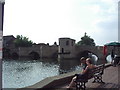
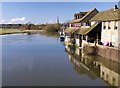
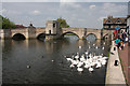
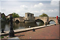
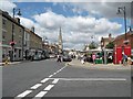
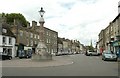
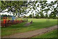
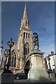
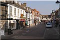
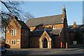
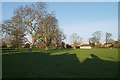
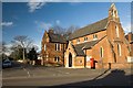
100 photos from this area
Area Information
Key information about the PE27 5BH including its size, population, and administrative classification.
- Area Type
- Postcode
- Area Size
- 1.3 hectares
- Population
- 2029
- Population Density
- 830 people/km²
House Prices in PE27 5BH
23
Properties
-
Average Sold Price
-
Lowest Price
-
Highest Price
Showing 23 properties
| Address | Type | Beds | Baths | Last Sale Price | Last Sale Date | |
|---|---|---|---|---|---|---|
| Flat 3, 12 Station Road, St Ives, PE27 5BH | Flat | - | - | - | - | |
| Montagu Physio Clinic, Ouse Valley House, Station Road, St Ives, PE27 5BH | commercial | - | - | - | - | |
| Source East, Electric Car Charging Point, Cattle Market Hdc Car Park, Meadow Lane, St Ives, PE27 5BH | Retail | - | - | - | - | |
| Flat, 2 Station Road, St Ives, PE27 5BH | Flat | 4 | 2 | - | - | |
| Moorwood Ltd, 15A Station Road, St Ives, PE27 5BH | Office | - | - | - | - | |
| Pan Agriculture Ltd, 5A Station Road, St Ives, PE27 5BH | Office | - | - | - | - | |
| Office 1, 11 Station Road, St Ives, PE27 5BH | Office | - | - | - | - | |
| Moorwood Ltd, 15 Station Road, St Ives, PE27 5BH | office_workshop | - | - | - | - | |
| Norman Ewing & Associates, 9 Station Road, St Ives, PE27 5BH | office_workshop | - | - | - | - | |
| Pizza Town, 3A Station Road, St Ives, PE27 5BH | restaurant_cafe | - | - | - | - |
Page 1 of 3
Energy Efficiency in PE27 5BH
Amenities
Schools
| Rank | School | Type | Entry gender | Ages |
|---|
Explore more schools in this area
Go to Schools tabDemographics
Household Size
One person
most common
Accommodation Type
Houses
most common
Tenure
37
majority
Ethnic Group
White
most common
Religion
N/A
most common
Household Composition
N/A
most common
Age
47
median
Adults (30-64 years)
most common
Household Deprivation
N/A
with no deprivation
NS-SEC
40
in Lower managerial occupations
Explore more demographic insights in this area
Go to Demographics tabPlanning
Planning Constraints
- Flood RiskPremium
- Ramsar Wetland SitesPremium
- Area of Outstanding Natural BeautyPremium
- Protected Nature ReservePremium
- Protected WoodlandPremium