Area Overview for PE27 3DT
Photos of PE27 3DT
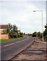
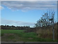

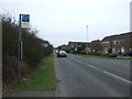
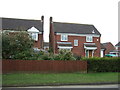

20 photos from this area
Area Information
Key information about the PE27 3DT including its size, population, and administrative classification.
- Area Type
- Postcode
- Area Size
- 1.4 hectares
- Population
- 1448
- Population Density
- 504 people/km²
House Prices in PE27 3DT
19
Properties
£276,541
Average Sold Price
£155,000
Lowest Price
£420,000
Highest Price
Showing 19 properties
| Address | Type | Beds | Baths | Last Sale Price | Last Sale Date | |
|---|---|---|---|---|---|---|
| 1 Arran Way, St Ives, PE27 3DT | Detached | 4 | - | £415,000 | Feb 2021 | |
| 10 Arran Way, St Ives, PE27 3DT | Detached | 4 | 2 | £420,000 | Feb 2018 | |
| 3 Arran Way, St Ives, PE27 3DT | Detached | 4 | 2 | £382,500 | Dec 2016 | |
| 2 Arran Way, St Ives, PE27 3DT | Detached | 4 | 1 | £310,000 | May 2016 | |
| 4 Arran Way, St Ives, PE27 3DT | Detached | 4 | - | £247,500 | Oct 2013 | |
| 12 Arran Way, St Ives, PE27 3DT | house | - | - | £219,950 | Aug 2011 | |
| 18 Arran Way, St Ives, PE27 3DT | Detached | 4 | 1 | £235,000 | May 2010 | |
| 14 Arran Way, St Ives, PE27 3DT | house | - | - | £247,000 | Dec 2009 | |
| 17 Arran Way, St Ives, PE27 3DT | Detached | - | - | £205,000 | Apr 2004 | |
| 15 Arran Way, St Ives, PE27 3DT | Detached | - | - | £205,000 | Dec 2003 |
Page 1 of 2
Energy Efficiency in PE27 3DT
Amenities
Schools
| Rank | School | Type | Entry gender | Ages |
|---|
Explore more schools in this area
Go to Schools tabDemographics
Household Size
Two person
most common
Accommodation Type
Houses
most common
Tenure
80
majority
Ethnic Group
White
most common
Religion
N/A
most common
Household Composition
N/A
most common
Age
47
median
Adults (30-64 years)
most common
Household Deprivation
N/A
with no deprivation
NS-SEC
43
in Lower managerial occupations
Explore more demographic insights in this area
Go to Demographics tabPlanning
Planning Constraints
- Flood RiskPremium
- Ramsar Wetland SitesPremium
- Area of Outstanding Natural BeautyPremium
- Protected Nature ReservePremium
- Protected WoodlandPremium