Area Overview for PE2 9QF
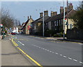
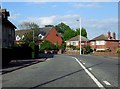
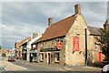
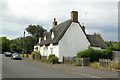
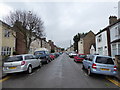
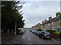
Photos of PE2 9QF

Area Information
Living in PE2 9QF means calling a small, tightly defined residential cluster home, where residents share a very specific environment. This postcode covers just under three thousand square metres, creating a neighbourhood with a recognisably focused footprint. You are part of a community of 2,624 people who navigate a landscape defined by its compact nature and high concentration of dwellings. The density here is extreme, with nearly 900,000 people per square kilometre according to the local records, which likely influences the pace of daily life and the proximity of neighbours. You join a population where adults dominate the scene, creating a community driven by those in their working lives. The area serves as a settled part of Peterborough, offering immediate access to the wider city while maintaining a distinct local identity. Residents benefit from a setting that is almost entirely dedicated to housing, providing a consistent backdrop for everyday routines. Whether you are commuting to Peterborough centre or Errington, the immediate surroundings are structured to support housing needs rather than sprawling commercial expansion. The character of PE2 9QF is one of established residential living, where the boundaries are clear and the sense of place comes from living among 2,600 peers in a shared, compact environment.
- Area Type
- Postcode
- Area Size
- 2947 m²
- Population
- 2624
- Population Density
- 4527 people/km²
The property market in PE2 9QF is characterised by a stock primarily composed of houses. With 43 per cent home ownership, a significant portion of residents own their property, which typically indicates a desire for stability and long-term residence. This figure suggests that while renting is prevalent, a strong segment of the market operates through ownership, making it a viable location for first-time buyers or those stepping up the property ladder from smaller rentals. The accommodation type is almost exclusively houses, meaning you will find detached, semi-detached, or terraced family homes rather than high-rise blocks or flats. Because this is a small residential cluster covering less than 3,000 square metres, competition for specific addresses can be intense when properties come to the market. Buyers often look to the immediate surroundings for comparison, meaning the value of homes in PE2 9QF will be heavily influenced by the condition of the street and the condition of the specific property. The area does not contain a mix of accommodation types, which simplifies the search for buyers seeking specific house styles but limits options for those looking for diverse housing choices. The market here is practical, catering to those who need space and a traditional house layout rather than a flat or unit.
House Prices in PE2 9QF
No properties found in this postcode.
Energy Efficiency in PE2 9QF
Daily life in PE2 9QF benefits from convenient access to a range of amenities within practical reach. For shoppers, you can visit Tesco Peterborough, Lidl Peterborough, and Budgens Fletton, all of which are listed as nearby retail options. These five venues provide a full suite of grocery choices, ensuring you can stock up on essentials without needing to travel far. Public transport connections are handled by four metro routes servicing Peterborough, Orton Mere, and Ferry Meadows, alongside two rail lines connecting to Peterborough Railway Station and Whittlesea Railway Station. This network allows you to commute easily into the city centre or access neighbouring towns. The presence of four metro routes suggests frequent trolleybus or local bus services that integrate well with train travel. Residents can reach Whittlesea Railway Station, which provides a rail link further south, or head to Peterborough Railway Station for national network access. Five retail outlets mean your weekly shop is always manageable, and two railway connections ensure your travel choices are rarely limited. The lifestyle here is defined by this accessibility, where daily needs are met through a combination of strong local retail and integrated public transport links that keep you connected to the wider region.
Amenities
Schools
Families considering PE2 9QF will find two nearby primary schools that cater to the educational needs of young children. Brewster Avenue Infant School operates as a primary establishment and holds a 'good' Ofsted rating. Residents will also find St Augustine's CofE (Voluntary Aided) Junior School within practical reach, which shares the same 'good' rating from Ofsted. Both schools provide a solid foundation for early education, ensuring that the area serves the needs of children who cannot yet attend secondary institutions locally. You have the option of choosing between these two providers, as the data confirms their status as 'good' rated institutions. This dual presence ensures that children do not have to travel far to access reputable primary education. The mix consists entirely of primary institutions, indicating that while there are young children in the area, there are no secondary schools listed for this specific postcode. Parents planning for their future will know that after primary education, students will need to seek secondary schooling options elsewhere in the city. The fact that both listed schools have received a 'good' rating provides a clear assurance of educational quality for those settling in this residential cluster.
| Rank | School | Type | Entry gender | Ages |
|---|---|---|---|---|
| 1 | Brewster Avenue Infant School | primary | N/A | N/A |
| 2 | St Augustine's CofE (Voluntary Aided) Junior School | primary | N/A | N/A |
Explore more schools in this area
Go to Schools tabDemographics
The community within PE2 9QF is defined by an older demographic profile, with a median age of 47 years. Most of the population falls into the adult range between 30 and 64 years old, suggesting a neighbourhood populated by established professionals or those nearing retirement rather than young families just starting out. This age distribution likely influences local demand, with children and teenagers being less common than in other parts of the city. Home ownership stands at 43 per cent, indicating that just under half of the households own their homes outright or with a mortgage, while the remainder rent. Houses form the predominant accommodation type, confirming that this is an area built for detached or semi-detached living rather than flats. The overwhelming majority of the population identifies as White, reflecting a homogenous community with a long-standing historical presence. You are looking at a settled group of people who have likely lived in their homes for many years rather than a transient rental market. There is no specific data on deprivation scores for this postcode, so you cannot make an assumption about income levels or poverty rates. The facts you do have point to a stable, adult-focused housing stock where ownership is relatively common for English standards.
Household Size
Accommodation Type
Tenure
Ethnic Group
Religion
Household Composition
Age
Household Deprivation
NS-SEC
Explore more demographic insights in this area
Go to Demographics tabPlanning
Planning Constraints
- Flood RiskPremium
- Ramsar Wetland SitesPremium
- Area of Outstanding Natural BeautyPremium
- Protected Nature ReservePremium
- Protected WoodlandPremium
- Crime RiskPremium